파일:85mapmacedonia.jpg
미리 보기 크기: 721 × 600 픽셀 다른 해상도: 289 × 240 픽셀 | 577 × 480 픽셀 | 924 × 768 픽셀 | 1,232 × 1,024 픽셀 | 2,000 × 1,663 픽셀
원본 파일 (2,000 × 1,663 픽셀, 파일 크기: 2.25 MB, MIME 종류: image/jpeg)

|
This map has been uploaded by Electionworld from en.wikipedia.org to enable the |
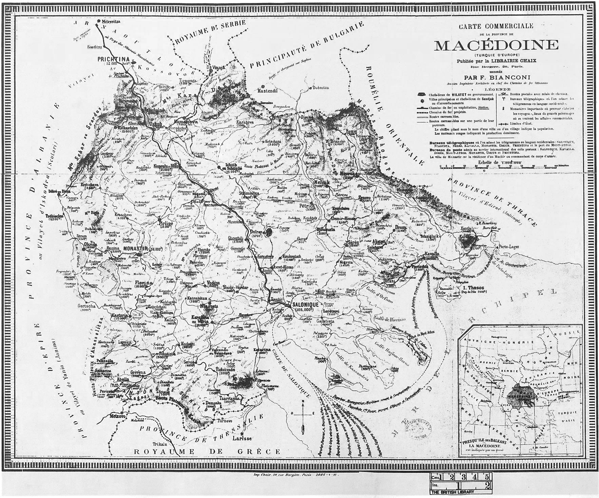
Map of Macedonia by F.Bianconi Paris, 1885
|
이 작품은 미국, 그리고 저작권 보호 기간이 저작자 사후 70년, 또는 그 이하인 모든 국가에서 퍼블릭 도메인입니다.
| |
| 이 저작물은 모든 저작인접권을 포함한 저작권법하의 규제로부터 자유로운 것으로 확인되었습니다. | |
파일 역사
날짜/시간 링크를 클릭하면 해당 시간의 파일을 볼 수 있습니다.
| 날짜/시간 | 섬네일 | 크기 | 사용자 | 설명 | |
|---|---|---|---|---|---|
| 현재 | 2014년 10월 7일 (화) 01:26 | | 2,000 × 1,663 (2.25 MB) | Enter514 | Larger version of the map: Province of Macedonia (European Turkey) by F.Bianconi Paris, 1885. |
| 2012년 8월 2일 (목) 02:39 |  | 936 × 690 (458 KB) | Mallowtek | 1° rotation as required | |
| 2012년 4월 26일 (목) 05:09 |  | 952 × 707 (485 KB) | McZusatz | greyscale | |
| 2006년 12월 21일 (목) 05:20 |  | 952 × 707 (282 KB) | Electionworld | {{ew|en|Makedonia}} Map of Macedonia by F.Bianconi Paris, 1885 {{PD-old-50}} Category:Maps of the history of the Republic of Macedonia Category:Maps of the history of Greece Category:Maps of the history of Bulgaria [[Category:Old maps of the |
이 파일을 사용하는 문서
다음 문서 1개가 이 파일을 사용하고 있습니다:
이 파일을 사용하고 있는 모든 위키의 문서 목록
다음 위키에서 이 파일을 사용하고 있습니다:
- be.wikipedia.org에서 이 파일을 사용하고 있는 문서 목록
- el.wikipedia.org에서 이 파일을 사용하고 있는 문서 목록
- en.wikipedia.org에서 이 파일을 사용하고 있는 문서 목록
- es.wikipedia.org에서 이 파일을 사용하고 있는 문서 목록
- fr.wikipedia.org에서 이 파일을 사용하고 있는 문서 목록
- gl.wikipedia.org에서 이 파일을 사용하고 있는 문서 목록
- ja.wikipedia.org에서 이 파일을 사용하고 있는 문서 목록
- tr.wikipedia.org에서 이 파일을 사용하고 있는 문서 목록
- uk.wikipedia.org에서 이 파일을 사용하고 있는 문서 목록
- www.wikidata.org에서 이 파일을 사용하고 있는 문서 목록
- zh.wikipedia.org에서 이 파일을 사용하고 있는 문서 목록