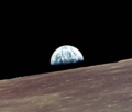
파일:Apollo 10 earthrise.png

미리 보기 크기: 704 × 599 픽셀 다른 해상도: 282 × 240 픽셀 | 564 × 480 픽셀 | 902 × 768 픽셀 | 1,036 × 882 픽셀
원본 파일 (1,036 × 882 픽셀, 파일 크기: 1.16 MB, MIME 종류: image/png)
파일 역사
날짜/시간 링크를 클릭하면 해당 시간의 파일을 볼 수 있습니다.
| 날짜/시간 | 섬네일 | 크기 | 사용자 | 설명 | |
|---|---|---|---|---|---|
| 현재 | 2017년 2월 2일 (목) 03:06 |  | 1,036 × 882 (1.16 MB) | Jstuby | higher resolution, cropped from original to match uploaded file [https://www.flickr.com/photos/projectapolloarchive/21716695748/in/album-72157658983205789/ AS10-27-3890] |
| 2009년 10월 16일 (금) 23:03 |  | 411 × 350 (50 KB) | Unpear | {{Information |Description=Apollo 10 earthrise |Source=http://www.wpclipart.com/geography/earth/Apollo_10_earthrise.png.html |Date=unknow |Author=don't need |Permission=Public Domain |other_versions=no }} |
이 파일을 사용하는 문서
다음 문서 1개가 이 파일을 사용하고 있습니다:
이 파일을 사용하고 있는 모든 위키의 문서 목록
다음 위키에서 이 파일을 사용하고 있습니다:
- ca.wikipedia.org에서 이 파일을 사용하고 있는 문서 목록
- de.wikipedia.org에서 이 파일을 사용하고 있는 문서 목록
- es.wikipedia.org에서 이 파일을 사용하고 있는 문서 목록
- hu.wikipedia.org에서 이 파일을 사용하고 있는 문서 목록
- ro.wikibooks.org에서 이 파일을 사용하고 있는 문서 목록
- vi.wikipedia.org에서 이 파일을 사용하고 있는 문서 목록
- zh.wikipedia.org에서 이 파일을 사용하고 있는 문서 목록

