파일:Battle of whitemarsh view.jpg

미리 보기 크기: 800 × 541 픽셀 다른 해상도: 320 × 217 픽셀 | 640 × 433 픽셀 | 851 × 576 픽셀
원본 파일 (851 × 576 픽셀, 파일 크기: 130 KB, MIME 종류: image/jpeg)
파일 설명
| 설명 |
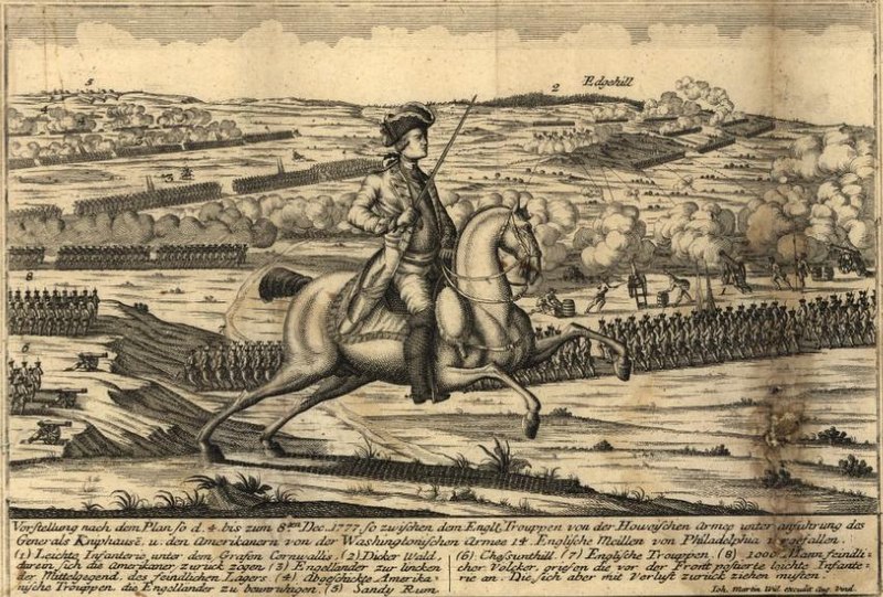
View from the British positions at the en:Battle of White Marsh. Chestnut Hill is in the lower left of the image, Sandy Run in the upper left, and Edge Hill in the upper right. Vorstellung nach dem Plan so d. 4. bis zum 8ten Dec. 1777 so zwischen dem Engl. Trouppen von der Howeischen Armee unter Anführung des Generals Kniphausē u. den Amerikanern von der Washingtonischen Armee 14 englische Meilen von Philadelphia vergefallen... |
| 날짜 | 2006년 9월 22일 (원본 올리기 일시) |
| 출처 | Library of Congress, Geography and Map Division. <http://hdl.loc.gov/loc.gmd/g3821sm.gas00001> (via en.wikipedia; description page is/was here). |
| 저자 | By Johann Martin Will. Map. Augsburg, Germany: ?, 1777 |
라이선스
|
이 작품은 미국, 그리고 저작권 보호 기간이 저작자 사후 70년, 또는 그 이하인 모든 국가에서 퍼블릭 도메인입니다.
| |
| 이 저작물은 모든 저작인접권을 포함한 저작권법하의 규제로부터 자유로운 것으로 확인되었습니다. | |
기존 올리기 기록
(All user names refer to en.wikipedia)
- 2006-09-22 22:53 Alphageekpa 851×576×8 (133411 bytes) == Summary == View from the British positions at the [[Battle of White Marsh]]. Chestnut Hill is in the lower left of the image, Sandy Run in the upper left, and Edge Hill in the upper right. ''Vorstellung nach dem Plan so d. 4. bis zum 8ten Dec. 1777 s
파일 역사
날짜/시간 링크를 클릭하면 해당 시간의 파일을 볼 수 있습니다.
| 날짜/시간 | 섬네일 | 크기 | 사용자 | 설명 | |
|---|---|---|---|---|---|
| 현재 | 2007년 10월 21일 (일) 01:18 | | 851 × 576 (130 KB) | Fryed-peach | {{Information |Description=View from the British positions at the en:Battle of White Marsh. Chestnut Hill is in the lower left of the image, Sandy Run in the upper left, and Edge Hill in the upper right. ''Vorstellung nach dem Plan so d. 4. bis zum |
이 파일을 사용하는 문서
다음 문서 1개가 이 파일을 사용하고 있습니다:
이 파일을 사용하고 있는 모든 위키의 문서 목록
다음 위키에서 이 파일을 사용하고 있습니다:
- en.wikipedia.org에서 이 파일을 사용하고 있는 문서 목록
- fr.wikipedia.org에서 이 파일을 사용하고 있는 문서 목록
- ja.wikipedia.org에서 이 파일을 사용하고 있는 문서 목록
- ru.wikipedia.org에서 이 파일을 사용하고 있는 문서 목록
- tl.wikipedia.org에서 이 파일을 사용하고 있는 문서 목록
- www.wikidata.org에서 이 파일을 사용하고 있는 문서 목록
- zh.wikipedia.org에서 이 파일을 사용하고 있는 문서 목록