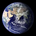
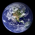
파일:BlueMarble-2001-2002.jpg

미리 보기 크기: 800 × 400 픽셀 다른 해상도: 320 × 160 픽셀 | 640 × 320 픽셀 | 1,024 × 512 픽셀 | 1,280 × 640 픽셀 | 2,560 × 1,280 픽셀 | 4,096 × 2,048 픽셀
원본 파일 (4,096 × 2,048 픽셀, 파일 크기: 1.22 MB, MIME 종류: image/jpeg)
파일 역사
날짜/시간 링크를 클릭하면 해당 시간의 파일을 볼 수 있습니다.
| 날짜/시간 | 섬네일 | 크기 | 사용자 | 설명 | |
|---|---|---|---|---|---|
| 현재 | 2009년 12월 21일 (월) 07:14 |  | 4,096 × 2,048 (1.22 MB) | Apoc2400 | High resolution. |
| 2005년 9월 3일 (토) 11:10 |  | 405 × 203 (19 KB) | Saperaud~commonswiki | NASA created these two images to exhibit high-resolution global composites of Moderate Resolution Imaging Spectroradiometer [http://modarch.gsfc.nasa.gov (MODIS)] data. The land surface data were acquired from June through September of 2001. The clouds we |
이 파일을 사용하는 문서
이 파일을 사용하고 있는 모든 위키의 문서 목록
다음 위키에서 이 파일을 사용하고 있습니다:
- af.wikipedia.org에서 이 파일을 사용하고 있는 문서 목록
- ar.wikipedia.org에서 이 파일을 사용하고 있는 문서 목록
- ast.wikipedia.org에서 이 파일을 사용하고 있는 문서 목록
- az.wikipedia.org에서 이 파일을 사용하고 있는 문서 목록
- ba.wikipedia.org에서 이 파일을 사용하고 있는 문서 목록
- be.wikipedia.org에서 이 파일을 사용하고 있는 문서 목록
- bh.wikipedia.org에서 이 파일을 사용하고 있는 문서 목록
- bn.wikipedia.org에서 이 파일을 사용하고 있는 문서 목록
- bo.wikipedia.org에서 이 파일을 사용하고 있는 문서 목록
- bs.wikipedia.org에서 이 파일을 사용하고 있는 문서 목록
- ca.wikipedia.org에서 이 파일을 사용하고 있는 문서 목록
- cs.wikipedia.org에서 이 파일을 사용하고 있는 문서 목록
- cy.wikipedia.org에서 이 파일을 사용하고 있는 문서 목록
- da.wikipedia.org에서 이 파일을 사용하고 있는 문서 목록
- de.wikipedia.org에서 이 파일을 사용하고 있는 문서 목록
- diq.wikipedia.org에서 이 파일을 사용하고 있는 문서 목록
- el.wikipedia.org에서 이 파일을 사용하고 있는 문서 목록
- en.wikipedia.org에서 이 파일을 사용하고 있는 문서 목록
- Marine biology
- Environmental movement
- Environmental science
- Twin Earth thought experiment
- Underwater environment
- The Blue Marble
- Ecosystem diversity
- Habitable zone
- Environmental history
- Origin of water on Earth
- Portal:Marine life
- Portal:Environment
- Portal:Environment/Selected article
- Portal:Environment/Selected article/14
- Sea
- Talk:Sustainability/Archive 8
- User:Nick carson/sandbox
- Talk:Sustainability/Lead
이 파일의 더 많은 사용 내역을 봅니다.


