파일:German east africa map.png
미리 보기 크기: 600 × 600 픽셀 다른 해상도: 240 × 240 픽셀 | 480 × 480 픽셀 | 768 × 768 픽셀 | 1,024 × 1,024 픽셀 | 2,000 × 2,000 픽셀
원본 파일 (2,000 × 2,000 픽셀, 파일 크기: 602 KB, MIME 종류: image/png)
파일 설명
| 설명 |
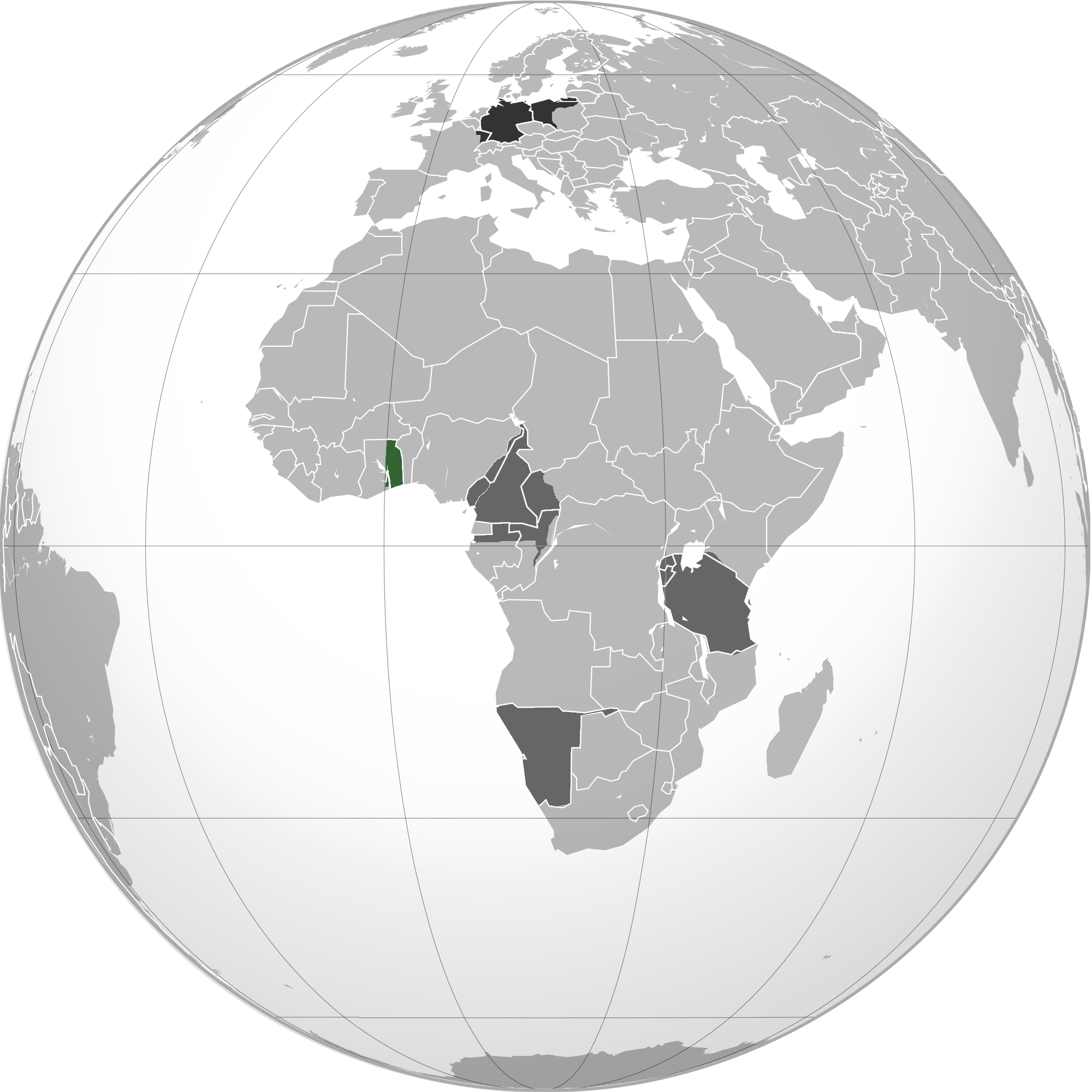
English: Green: Territory comprising German colony of German East Africa Dark gray: Other German possessions Darkest gray: German Empire Note: The map uses the borders of the present-day, but the historical extent for German territories are depicted. |
| 날짜 | 2010년 6월 2일 (원본 올리기 일시) |
| 출처 | 원판 업로더 자신의 작품 |
| 저자 | User:VoodooIsland |
라이선스
| 이 작품은 저작자인 VoodooIsland에 의해 퍼블릭 도메인으로 공개된 작품입니다. 이 공개 선언은 전 세계적으로 유효합니다. 만약 저작권의 포기가 법률적으로 가능하지 않은 경우, |
기존 올리기 기록
For the Common Good 도구를 사용하여 en.wikipedia에서 공용으로 옮겨왔습니다.
The original description page was here. All following user names refer to en.wikipedia.
| 날짜/시간 | 크기 | 사용자 | 설명 |
|---|---|---|---|
| 20:43, 2 June 2010 | 2,000 × 2,000 (609,979 bytes) | w:en:VoodooIsland (토론 | 기여) | '''Green''': Territory comprising German colony of German East Africa<br>'''Dark gray''': Other [[German colonial empire|German possessions]]<br>'''Darkest gray''': [[German Empire]] '''Note''': The map uses the borders of the present-day, but the histor |
파일 역사
날짜/시간 링크를 클릭하면 해당 시간의 파일을 볼 수 있습니다.
| 날짜/시간 | 섬네일 | 크기 | 사용자 | 설명 | |
|---|---|---|---|---|---|
| 현재 | 2023년 2월 11일 (토) 00:41 | | 2,000 × 2,000 (602 KB) | Goran tek-en | Added border of South Sudan as requested by Maphobbyist |
| 2014년 3월 22일 (토) 01:03 |  | 2,000 × 2,000 (596 KB) | XXN | Transferred from en.wikipedia: see original upload log above |
이 파일을 사용하는 문서
이 파일을 사용하는 문서가 없습니다.
이 파일을 사용하고 있는 모든 위키의 문서 목록
다음 위키에서 이 파일을 사용하고 있습니다:
- af.wikipedia.org에서 이 파일을 사용하고 있는 문서 목록
- ar.wikipedia.org에서 이 파일을 사용하고 있는 문서 목록
- azb.wikipedia.org에서 이 파일을 사용하고 있는 문서 목록
- bg.wikipedia.org에서 이 파일을 사용하고 있는 문서 목록
- cs.wikipedia.org에서 이 파일을 사용하고 있는 문서 목록
- he.wikipedia.org에서 이 파일을 사용하고 있는 문서 목록
- id.wikipedia.org에서 이 파일을 사용하고 있는 문서 목록
- it.wikipedia.org에서 이 파일을 사용하고 있는 문서 목록
- ka.wikipedia.org에서 이 파일을 사용하고 있는 문서 목록
- lt.wikipedia.org에서 이 파일을 사용하고 있는 문서 목록
- ms.wikipedia.org에서 이 파일을 사용하고 있는 문서 목록
- nl.wikipedia.org에서 이 파일을 사용하고 있는 문서 목록
- pnb.wikipedia.org에서 이 파일을 사용하고 있는 문서 목록
- pt.wikipedia.org에서 이 파일을 사용하고 있는 문서 목록
- sco.wikipedia.org에서 이 파일을 사용하고 있는 문서 목록
- th.wikipedia.org에서 이 파일을 사용하고 있는 문서 목록
- tr.wikipedia.org에서 이 파일을 사용하고 있는 문서 목록
- uk.wikipedia.org에서 이 파일을 사용하고 있는 문서 목록
- vi.wikipedia.org에서 이 파일을 사용하고 있는 문서 목록
- zh.wikipedia.org에서 이 파일을 사용하고 있는 문서 목록