파일:Map of Alaska highlighting Juneau City and Borough.svg

SVG 파일의 PNG 형식의 미리보기 크기: 800 × 423 픽셀. 다른 해상도: 320 × 169 픽셀 | 640 × 338 픽셀 | 1,024 × 541 픽셀 | 1,280 × 677 픽셀 | 2,560 × 1,353 픽셀 | 1,470 × 777 픽셀
원본 파일 (SVG 파일, 실제 크기 1,470 × 777 픽셀, 파일 크기: 338 KB)
파일 설명
| 설명 |
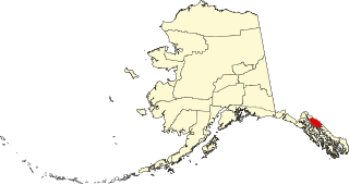
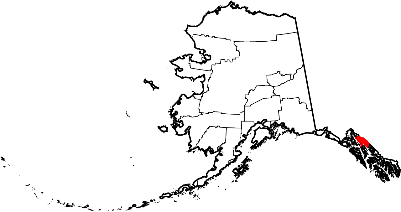
English: This is a locator map showing Juneau City and Borough in Alaska |
| 날짜 | |
| 출처 |
자작: English: The maps use data from nationalatlas.gov, specifically countyp020.tar.gz on the Raw Data Download page. The maps also use state outline data from statesp020.tar.gz. The Florida maps use hydrogm020.tar.gz to display Lake Okeechobee. |
| 저자 | David Benbennick |
라이선스
| 나는 이 작품의 저작권자로서, 이 작품을 퍼블릭 도메인으로 모두에게 공개합니다. 이 공개 선언은 전 세계적으로 유효합니다. 만약 저작권의 포기가 법률적으로 가능하지 않은 경우, 나는 이 작품을 법적으로 허용되는 한도 내에서 누구나 자유롭게 어떤 목적으로도 제한없이 사용할 수 있도록 허용합니다. |
파일 역사
날짜/시간 링크를 클릭하면 해당 시간의 파일을 볼 수 있습니다.
| 날짜/시간 | 섬네일 | 크기 | 사용자 | 설명 | |
|---|---|---|---|---|---|
| 현재 | 2006년 3월 6일 (월) 04:26 | | 1,470 × 777 (338 KB) | David Benbennick | {{subst:User:Dbenbenn/clm|county=Juneau City and Borough|state=Alaska|type=borough and census area}} |
이 파일을 사용하는 문서
다음 문서 2개가 이 파일을 사용하고 있습니다:
이 파일을 사용하고 있는 모든 위키의 문서 목록
다음 위키에서 이 파일을 사용하고 있습니다:
- bpy.wikipedia.org에서 이 파일을 사용하고 있는 문서 목록
- ca.wikipedia.org에서 이 파일을 사용하고 있는 문서 목록
- de.wikipedia.org에서 이 파일을 사용하고 있는 문서 목록
- en.wikipedia.org에서 이 파일을 사용하고 있는 문서 목록
- List of boroughs and census areas in Alaska
- Juneau Empire
- Eaglecrest Ski Area
- Stephens Passage
- Gastineau Channel
- Wikipedia:WikiProject Alaska
- Capital City Weekly
- Adair-Kennedy Memorial Park
- Mount Roberts (Alaska)
- Lincoln Island (Alaska)
- Point Sherman Light
- Sentinel Island Light
- Mendenhall Lake
- ABC Islands (Alaska)
- Red Dog Saloon
- Alaska Electric Light & Power
- Snettisham hydroelectric power plant
- Quartz Gulch
- Dipyramid (Alaska)
- Vanderbilt Reef
- Taku Harbor
- Template:JuneauAK-geo-stub
- National Register of Historic Places listings in Juneau, Alaska
- Mount Nesselrode
- Whiting River
- Auke Lake
- Kakuhan Range
- Nugget Falls
- Thunder Mountain High School
- Douglas Harbor
- Lena Beach, Juneau
- Kootznoowoo Wilderness
- Bacon Glacier
- New Boston, Juneau
- Starr Hill, Juneau
- West Juneau, Alaska
- Aaron Island (Alaska)
- Tolch Rock
- Fish Creek (Douglas Island, Juneau, Alaska)
- Tee Harbor, Juneau
- Amherst Peak
- Table Top Mountain (Juneau, Alaska)
- Mount Troy
- Ninemile Creek (Juneau, Alaska)
- Celebration (Alaska festival)
- Elevenmile Creek
이 파일의 더 많은 사용 내역을 봅니다.