파일:Mole Valley UK locator map.svg

SVG 파일의 PNG 형식의 미리보기 크기: 790 × 599 픽셀. 다른 해상도: 317 × 240 픽셀 | 633 × 480 픽셀 | 1,013 × 768 픽셀 | 1,280 × 971 픽셀 | 2,560 × 1,942 픽셀 | 1,425 × 1,081 픽셀
원본 파일 (SVG 파일, 실제 크기 1,425 × 1,081 픽셀, 파일 크기: 948 KB)
| 설명 |
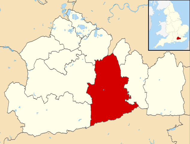
Map of Surrey, UK with Mole Valley highlighted. Equirectangular map projection on WGS 84 datum, with N/S stretched 160% |
| 날짜 | |
| 출처 |
|
| 저자 | Nilfanion, created using Ordnance Survey data |
| 저작권 (이 파일을 인용하기) |
이 파일은 크리에이티브 커먼즈 저작자표시-동일조건변경허락 3.0 Unported 라이선스로 배포됩니다. 저작자표시: Contains Ordnance Survey data © Crown copyright and database right
|
파일 역사
날짜/시간 링크를 클릭하면 해당 시간의 파일을 볼 수 있습니다.
| 날짜/시간 | 섬네일 | 크기 | 사용자 | 설명 | |
|---|---|---|---|---|---|
| 현재 | 2011년 8월 2일 (화) 18:26 | | 1,425 × 1,081 (948 KB) | Nilfanion | {{Information |Description=Map of Surrey, UK with Mole Valley highlighted. Equirectangular map projection on WGS 84 datum, with N/S stretched 160% |Source=Ordnance Survey [https://www.ordnancesurvey.co |
이 파일을 사용하는 문서
다음 문서 1개가 이 파일을 사용하고 있습니다:
이 파일을 사용하고 있는 모든 위키의 문서 목록
다음 위키에서 이 파일을 사용하고 있습니다:
- cy.wikipedia.org에서 이 파일을 사용하고 있는 문서 목록
- en.wikipedia.org에서 이 파일을 사용하고 있는 문서 목록
- Dorking
- Ashtead
- Leatherhead
- Fetcham
- Great Bookham
- Little Bookham
- Mole Valley
- Box Hill, Surrey
- City of London Freemen's School
- Abinger Hammer
- Leith Hill
- Headley Court
- Denbies Wine Estate
- Brockham
- Mickleham, Surrey
- Charlwood
- Westcott, Surrey
- St John's School, Leatherhead
- Polesden Lacey
- Bookham Commons
- Newdigate
- Abinger
- Betchworth
- Buckland, Surrey
- Westhumble
- Leatherhead F.C.
- Dorking F.C.
- The Ashcombe School
- Bookham F.C.
- Ashtead Common
- Bocketts Farm
- Headley, Surrey
- Ashtead railway station
- Mullard Space Science Laboratory
- Box Hill & Westhumble railway station
- Cherkley Court
- Leatherhead railway station
- Dorking railway station
- Holmwood railway station
- Ockley railway station
- Downsend School
- Box Hill School
- Bookham railway station
- Betchworth railway station
- Dorking West railway station
- Church of St Mary, Fetcham
- Dorking Deepdene railway station
- Leigh, Surrey
- St Andrew's Catholic School
이 파일의 더 많은 사용 내역을 봅니다.