파일:Muscat harbor.jpg
미리 보기 크기: 772 × 600 픽셀 다른 해상도: 309 × 240 픽셀 | 618 × 480 픽셀 | 988 × 768 픽셀 | 1,280 × 995 픽셀 | 1,539 × 1,196 픽셀
원본 파일 (1,539 × 1,196 픽셀, 파일 크기: 692 KB, MIME 종류: image/jpeg)
파일 설명
| 설명 |
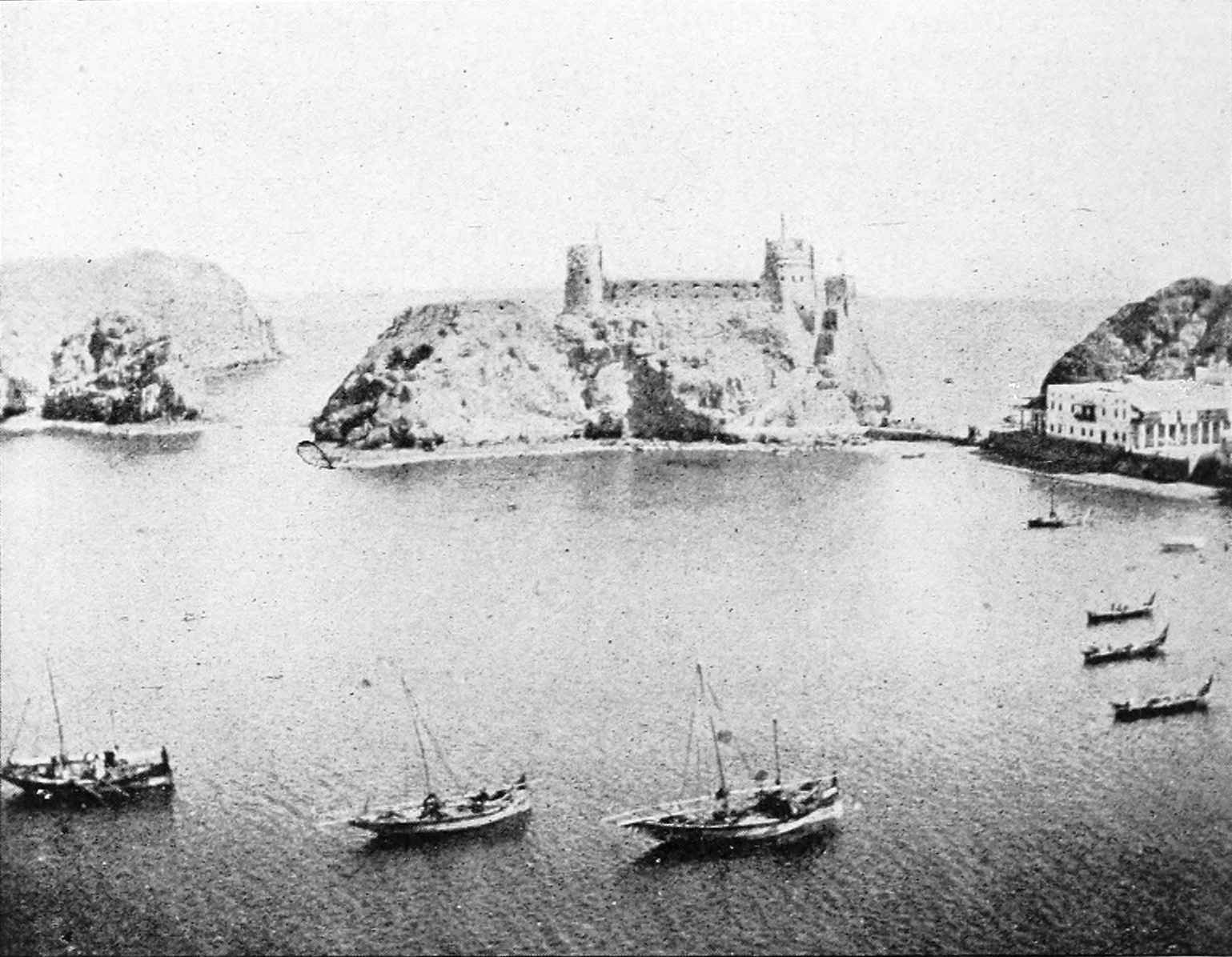
English: This is an image of Muscat harbor, taken from a book published in 1903 (PD). Refer to page 744 in the book for the image. |
||||||
| 날짜 | |||||||
| 출처 | https://archive.org/details/bub_gb_6i4wAAAAYAAJ | ||||||
| 저자 | Hermann Vollrat Hilprecht, Immanuel Benzinger, Fritz Hommel, Peter Jensen, Peter Christian Albrecht Jensen, Georg Steindorff | ||||||
| 저작권 (이 파일을 인용하기) |
|
| 카메라 위치 | | 이 지역의 다른 사진을 보기: OpenStreetMap |
|---|
라이선스
This media file is in the public domain in the United States. This applies to U.S. works where the copyright has expired, often because its first publication occurred prior to January 1, 1929, and if not then due to lack of notice or renewal. See this page for further explanation.
|
 | |
 |
This image might not be in the public domain outside of the United States; this especially applies in the countries and areas that do not apply the rule of the shorter term for US works, such as Canada, Mainland China (not Hong Kong or Macao), Germany, Mexico, and Switzerland. The creator and year of publication are essential information and must be provided. See Wikipedia:Public domain and Wikipedia:Copyrights for more details.
|
파일 역사
날짜/시간 링크를 클릭하면 해당 시간의 파일을 볼 수 있습니다.
| 날짜/시간 | 섬네일 | 크기 | 사용자 | 설명 | |
|---|---|---|---|---|---|
| 현재 | 2015년 8월 21일 (금) 23:53 | | 1,539 × 1,196 (692 KB) | Storkk | better version from archive.org |
| 2008년 9월 22일 (월) 12:45 |  | 492 × 383 (51 KB) | AreJay | {{Information |Description={{en|1=This is an image of Muscat harbor, taken from a book published in 1903 (PD). Refer to page 744 in the book for the image.}} |Source=http://books.google.com/books?id=BOoSAAAAYAAJ&pg=PR23&lr=&as_brr=1#PRA1-PA744,M1 |Au |
이 파일을 사용하는 문서
다음 문서 2개가 이 파일을 사용하고 있습니다:
이 파일을 사용하고 있는 모든 위키의 문서 목록
다음 위키에서 이 파일을 사용하고 있습니다:
- af.wikipedia.org에서 이 파일을 사용하고 있는 문서 목록
- ar.wikipedia.org에서 이 파일을 사용하고 있는 문서 목록
- azb.wikipedia.org에서 이 파일을 사용하고 있는 문서 목록
- cs.wikipedia.org에서 이 파일을 사용하고 있는 문서 목록
- da.wikipedia.org에서 이 파일을 사용하고 있는 문서 목록
- de.wikipedia.org에서 이 파일을 사용하고 있는 문서 목록
- el.wikipedia.org에서 이 파일을 사용하고 있는 문서 목록
- en.wikipedia.org에서 이 파일을 사용하고 있는 문서 목록
- es.wikipedia.org에서 이 파일을 사용하고 있는 문서 목록
- fi.wikipedia.org에서 이 파일을 사용하고 있는 문서 목록
- fr.wikipedia.org에서 이 파일을 사용하고 있는 문서 목록
- ha.wikipedia.org에서 이 파일을 사용하고 있는 문서 목록
- he.wikipedia.org에서 이 파일을 사용하고 있는 문서 목록
- id.wikipedia.org에서 이 파일을 사용하고 있는 문서 목록
- it.wikipedia.org에서 이 파일을 사용하고 있는 문서 목록
- ja.wikipedia.org에서 이 파일을 사용하고 있는 문서 목록
- ka.wikipedia.org에서 이 파일을 사용하고 있는 문서 목록
- kn.wikipedia.org에서 이 파일을 사용하고 있는 문서 목록
- mt.wikipedia.org에서 이 파일을 사용하고 있는 문서 목록
- nn.wikipedia.org에서 이 파일을 사용하고 있는 문서 목록
- pl.wikipedia.org에서 이 파일을 사용하고 있는 문서 목록
- pt.wikipedia.org에서 이 파일을 사용하고 있는 문서 목록
- ru.wikipedia.org에서 이 파일을 사용하고 있는 문서 목록
- sl.wikipedia.org에서 이 파일을 사용하고 있는 문서 목록
- sv.wikipedia.org에서 이 파일을 사용하고 있는 문서 목록
- vi.wikipedia.org에서 이 파일을 사용하고 있는 문서 목록
- zh.wikipedia.org에서 이 파일을 사용하고 있는 문서 목록