파일:Typhoon Etau 2003.jpg

미리 보기 크기: 523 × 600 픽셀 다른 해상도: 209 × 240 픽셀 | 418 × 480 픽셀 | 669 × 768 픽셀 | 893 × 1,024 픽셀 | 1,785 × 2,048 픽셀 | 6,800 × 7,800 픽셀
원본 파일 (6,800 × 7,800 픽셀, 파일 크기: 5.9 MB, MIME 종류: image/jpeg)
| 주의 | 이 그림은 크기가 상당히 크며, 일부 브라우저의 경우 그림을 실제 크기로 표시할 때 프로그램이 멈출 수 있습니다. 이 경우, '최대 해상도' 링크 위에서 마우스 오른쪽 버튼을 눌러서 컴퓨터 파일로 저장한 다음, 포토샵이나 GIMP 같은 편집기를 이용해서 파일을 열어 주세요. |
|---|
파일 설명
| 설명 |
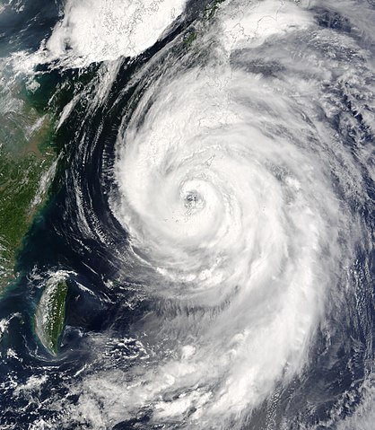
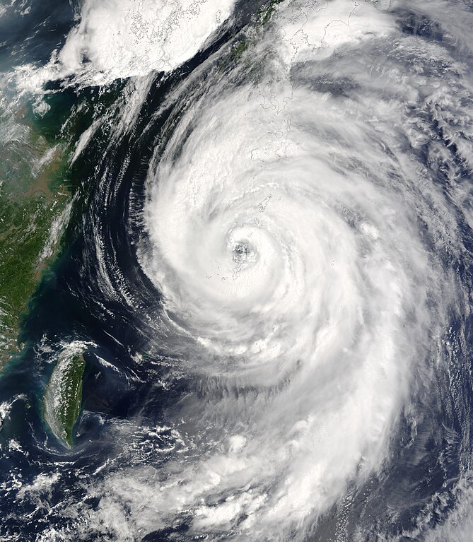
The MODIS instrument onboard NASA’s Terra spacecraft captured this bird’s-eye view of Typhoon Etau as it was buffeting the southern island chain of Okinawa, affecting airlines, a refinery and other industries. In this image the center of Etau is located just north of Nago city and is moving north at 20 kilometers per hour with sustained winds of 144 kilometers per hour. Forecasters are predicting the storm will reach Kagoshima city on Kyushu island tomorrow and then veer off to the Sea of Japan, avoiding Tokyo. |
|||||
| 날짜 | ||||||
| 출처 | http://visibleearth.nasa.gov/view_rec.php?id=5719 | |||||
| 저자 | Jacques Descloitres, MODIS Rapid Response Team, NASA/GSFC | |||||
| 저작권 (이 파일을 인용하기) |
|

파일 역사
날짜/시간 링크를 클릭하면 해당 시간의 파일을 볼 수 있습니다.
| 날짜/시간 | 섬네일 | 크기 | 사용자 | 설명 | |
|---|---|---|---|---|---|
| 현재 | 2006년 9월 5일 (화) 01:59 | | 6,800 × 7,800 (5.9 MB) | Good kitty | == Summary == {{Information |Description=The MODIS instrument onboard NASA’s Terra spacecraft captured this bird’s-eye view of Typhoon Etau as it was buffeting the southern island chain of Okinawa, affecting airlines, a refinery and other industries. |
이 파일을 사용하는 문서
다음 문서 1개가 이 파일을 사용하고 있습니다:
이 파일을 사용하고 있는 모든 위키의 문서 목록
다음 위키에서 이 파일을 사용하고 있습니다:
- en.wikipedia.org에서 이 파일을 사용하고 있는 문서 목록
- es.wikipedia.org에서 이 파일을 사용하고 있는 문서 목록
- ja.wikipedia.org에서 이 파일을 사용하고 있는 문서 목록
- pt.wikipedia.org에서 이 파일을 사용하고 있는 문서 목록
- th.wikipedia.org에서 이 파일을 사용하고 있는 문서 목록
- vi.wikipedia.org에서 이 파일을 사용하고 있는 문서 목록
- zh.wikipedia.org에서 이 파일을 사용하고 있는 문서 목록