파일:UNMIK map.png
원본 파일 (783 × 1,022 픽셀, 파일 크기: 336 KB, MIME 종류: image/png)

|
이 그림 파일은 벡터 SVG 형식으로 다시 만들어야 합니다. SVG의 장점에 대해서는 여기(영어)를 참고해 주십시오. 만약 이 그림의 SVG 버전이 이미 존재한다면 이 틀을 {{vector version available|새 파일 이름.svg}}으로 대체해 주십시오.
|
| 설명 |
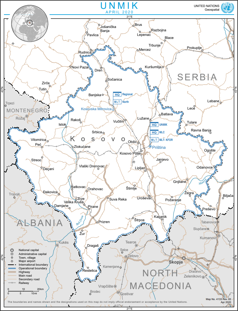
English: Map of Kosovo UNMIK Mission |
|||
| 날짜 | ||||
| 출처 | The Cartographic Section of the United Nations (CSUN) | |||
| 저자 | Cartographer of the United Nations | |||
| 저작권 (이 파일을 인용하기) |
|

파일 역사
날짜/시간 링크를 클릭하면 해당 시간의 파일을 볼 수 있습니다.
| 날짜/시간 | 섬네일 | 크기 | 사용자 | 설명 | |
|---|---|---|---|---|---|
| 현재 | 2020년 8월 26일 (수) 05:53 | | 783 × 1,022 (336 KB) | Savasampion | Update |
| 2013년 10월 15일 (화) 21:34 |  | 615 × 768 (234 KB) | Bobrayner | updating to reflect 2008 borders, per File talk:Continental-Europe-map.png | |
| 2013년 10월 15일 (화) 20:29 |  | 1,880 × 2,356 (887 KB) | WhiteWriter | Reverted to version as of 19:26, 8 July 2010 | |
| 2013년 9월 25일 (수) 22:28 |  | 615 × 768 (234 KB) | No More Cats | UN's latest revision of their map. | |
| 2010년 7월 9일 (금) 04:26 |  | 1,880 × 2,356 (887 KB) | MacedonianBoy | поправки. | |
| 2007년 3월 10일 (토) 08:05 |  | 1,880 × 2,356 (780 KB) | Minestrone | UNMIK map {{Information |Description=Map of Kosovo UNMIK Mission |Source=The Cartographic Section of the United Nations (CSUN) |Date=2007-03-10 |Author=Cartographer of the United Nations |Permission={{Template:UN map}} and the cartographer of the UN |
이 파일을 사용하는 문서
다음 문서 1개가 이 파일을 사용하고 있습니다:
이 파일을 사용하고 있는 모든 위키의 문서 목록
다음 위키에서 이 파일을 사용하고 있습니다:
- ar.wikipedia.org에서 이 파일을 사용하고 있는 문서 목록
- bg.wikipedia.org에서 이 파일을 사용하고 있는 문서 목록
- ca.wikipedia.org에서 이 파일을 사용하고 있는 문서 목록
- da.wikipedia.org에서 이 파일을 사용하고 있는 문서 목록
- de.wikipedia.org에서 이 파일을 사용하고 있는 문서 목록
- el.wikipedia.org에서 이 파일을 사용하고 있는 문서 목록
- en.wikipedia.org에서 이 파일을 사용하고 있는 문서 목록
- eo.wikipedia.org에서 이 파일을 사용하고 있는 문서 목록
- es.wikipedia.org에서 이 파일을 사용하고 있는 문서 목록
- gl.wikipedia.org에서 이 파일을 사용하고 있는 문서 목록
- hr.wikipedia.org에서 이 파일을 사용하고 있는 문서 목록
- id.wikipedia.org에서 이 파일을 사용하고 있는 문서 목록
- it.wikipedia.org에서 이 파일을 사용하고 있는 문서 목록
- ja.wikipedia.org에서 이 파일을 사용하고 있는 문서 목록
- nl.wikipedia.org에서 이 파일을 사용하고 있는 문서 목록
- no.wikipedia.org에서 이 파일을 사용하고 있는 문서 목록
- pt.wikipedia.org에서 이 파일을 사용하고 있는 문서 목록
- ro.wikipedia.org에서 이 파일을 사용하고 있는 문서 목록
- sh.wikipedia.org에서 이 파일을 사용하고 있는 문서 목록
- sr.wikipedia.org에서 이 파일을 사용하고 있는 문서 목록
- sv.wikipedia.org에서 이 파일을 사용하고 있는 문서 목록
- tr.wikipedia.org에서 이 파일을 사용하고 있는 문서 목록
- uk.wikipedia.org에서 이 파일을 사용하고 있는 문서 목록
- www.wikidata.org에서 이 파일을 사용하고 있는 문서 목록