파일:Yongsan.jpg
미리 보기 크기: 462 × 599 픽셀 다른 해상도: 185 × 240 픽셀 | 370 × 480 픽셀 | 592 × 768 픽셀 | 790 × 1,024 픽셀 | 1,579 × 2,048 픽셀 | 2,699 × 3,500 픽셀
원본 파일 (2,699 × 3,500 픽셀, 파일 크기: 3.74 MB, MIME 종류: image/jpeg)
파일 설명
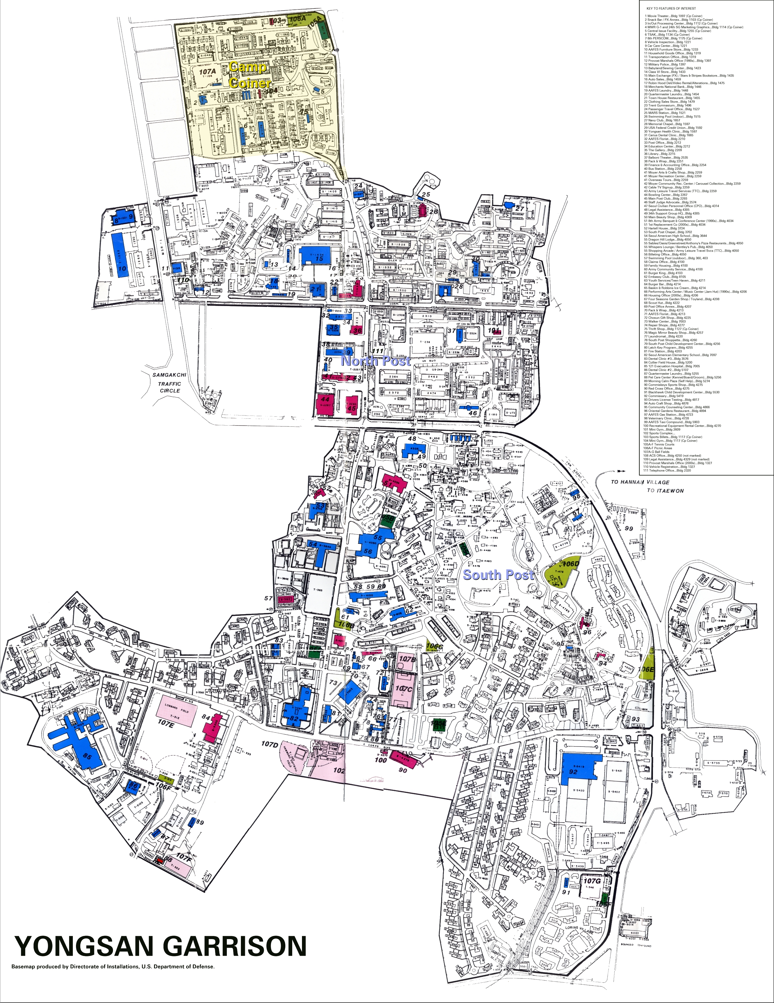
| 설명 | Yongsan Garrison Map, 1990. Master Plan of 1990, Directorate of Installations, United States Department of Defense. |
| 출처 | |
| 저자 |
라이선스
이 파일은 미국 법전 제17편 제1장 제105조에 따른 미국 연방정부의 공무원 또는 피고용인이 공무상 작성한 저작물로, 미국에서 퍼블릭 도메인입니다.
주의: 본 라이선스는 미국 연방정부의 저작물에 관해서만 효력이 있습니다. 미국의 주, 군, 기타 지방자치단체가 만든 저작물에 대해서는 적용되지 않습니다. 또한 미국 우정청이 1978년부터 발행한 우표 디자인에도 적용되지 않습니다.
|
 | |
| 이 저작물은 모든 저작인접권을 포함한 저작권법하의 규제로부터 자유로운 것으로 확인되었습니다. | ||
기존 올리기 기록
The original description page was here. All following user names refer to en.wikipedia.
- 2007-01-25 20:39 Rolypolyman 2699×3500×8 (3918687 bytes) Yongsan Garrison Map, 1990. Master Plan of 1990, Directorate of Installations, United States Department of Defense.
- 2007-01-25 01:09 Rolypolyman 2699×3500×8 (3963197 bytes) Yongsan Garrison Map, 1995. Master Plan of 1995, Directorate of Installations, United States Department of Defense.
파일 역사
날짜/시간 링크를 클릭하면 해당 시간의 파일을 볼 수 있습니다.
| 날짜/시간 | 섬네일 | 크기 | 사용자 | 설명 | |
|---|---|---|---|---|---|
| 현재 | 2007년 8월 11일 (토) 12:53 | | 2,699 × 3,500 (3.74 MB) | WonYong~commonswiki | {{Information |Description=Yongsan Garrison Map, 1990. Master Plan of 1990, Directorate of Installations, United States Department of Defense. |Source=Originally from [http://en.wikipedia.org en.wikipedia]; description page is/was [http://en.wikipedia.or |
이 파일을 사용하는 문서
이 파일을 사용하고 있는 모든 위키의 문서 목록
다음 위키에서 이 파일을 사용하고 있습니다:
- de.wikipedia.org에서 이 파일을 사용하고 있는 문서 목록
- en.wikipedia.org에서 이 파일을 사용하고 있는 문서 목록
- ja.wikipedia.org에서 이 파일을 사용하고 있는 문서 목록
- no.wikipedia.org에서 이 파일을 사용하고 있는 문서 목록
- zh.wikipedia.org에서 이 파일을 사용하고 있는 문서 목록