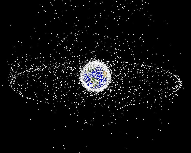
파일:Debris-GEO1280.jpg

미리 보기 크기: 750 × 600 픽셀 다른 해상도: 300 × 240 픽셀 | 600 × 480 픽셀 | 960 × 768 픽셀 | 1,280 × 1,024 픽셀
원본 파일 (1,280 × 1,024 픽셀, 파일 크기: 125 KB, MIME 종류: image/jpeg)
파일 역사
날짜/시간 링크를 클릭하면 해당 시간의 파일을 볼 수 있습니다.
| 날짜/시간 | 섬네일 | 크기 | 사용자 | 설명 | |
|---|---|---|---|---|---|
| 현재 | 2005년 2월 2일 (수) 01:45 |  | 1,280 × 1,024 (125 KB) | Srbauer | debris plot by NASA |
이 파일을 사용하는 문서
이 파일을 사용하고 있는 모든 위키의 문서 목록
다음 위키에서 이 파일을 사용하고 있습니다:
- af.wikipedia.org에서 이 파일을 사용하고 있는 문서 목록
- an.wikipedia.org에서 이 파일을 사용하고 있는 문서 목록
- ar.wikipedia.org에서 이 파일을 사용하고 있는 문서 목록
- az.wikipedia.org에서 이 파일을 사용하고 있는 문서 목록
- be-tarask.wikipedia.org에서 이 파일을 사용하고 있는 문서 목록
- be.wikipedia.org에서 이 파일을 사용하고 있는 문서 목록
- bn.wikipedia.org에서 이 파일을 사용하고 있는 문서 목록
- ca.wikipedia.org에서 이 파일을 사용하고 있는 문서 목록
- cs.wikipedia.org에서 이 파일을 사용하고 있는 문서 목록
- da.wikipedia.org에서 이 파일을 사용하고 있는 문서 목록
- de.wikipedia.org에서 이 파일을 사용하고 있는 문서 목록
- de.wiktionary.org에서 이 파일을 사용하고 있는 문서 목록
- el.wikipedia.org에서 이 파일을 사용하고 있는 문서 목록
- en.wikipedia.org에서 이 파일을 사용하고 있는 문서 목록
- Earth
- International Space Station
- Geosynchronous orbit
- Geostationary orbit
- Envisat
- Outer space
- Talk:Geostationary orbit
- Planetes
- Kessler syndrome
- Portal:Outer space
- Spacecraft cemetery
- Catcher's Mitt
- Human presence in space
- User talk:Penyulap/staticEnglish
- Space Surveillance Telescope
- User:Ginnybarnes/Spacecraft cemetery
- Portal:World
- User:FreshYoMama/TWA/Earth
- User:FreshYoMama/TWA/Earth/2
- User:Mumuhuohuo
- Draft:Space Congestion
- en.wikinews.org에서 이 파일을 사용하고 있는 문서 목록
- eo.wikipedia.org에서 이 파일을 사용하고 있는 문서 목록
- es.wikipedia.org에서 이 파일을 사용하고 있는 문서 목록
이 파일의 더 많은 사용 내역을 봅니다.


