파일:Guatemala location map.svg

SVG 파일의 PNG 형식의 미리보기 크기: 545 × 599 픽셀. 다른 해상도: 218 × 240 픽셀 | 436 × 480 픽셀 | 698 × 768 픽셀 | 931 × 1,024 픽셀 | 1,862 × 2,048 픽셀 | 982 × 1,080 픽셀
원본 파일 (SVG 파일, 실제 크기 982 × 1,080 픽셀, 파일 크기: 120 KB)
파일 설명
| 설명 |
Deutsch: Positionskarte von Guatemala
Quadratische Plattkarte Русский: Карта расположения Гватемалы
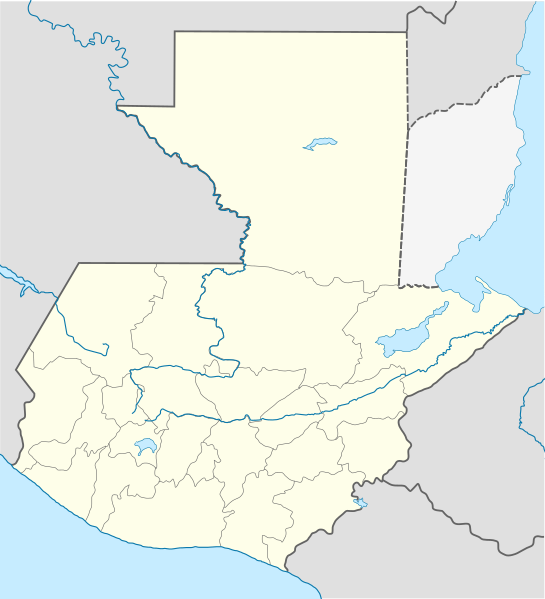
English: Location map of Guatemala
Equirectangular projection, Geographic limits of the map:
Հայերեն: Գվատեմալայի տեղորոշման քարտեզ
Ուղղանկյուն պրոյեկցիա։ Քարտեզում աշխարհագրական սահմանները.
|
||
| 날짜 | |||
| 출처 | |||
| 저자 |
|
||
| SVG 발전 | 이 SVG 파일의 소스 코드를 6가지의 실수입니다. 이 W3C-무효 벡터 그림은 Adobe Illustrator(으)로 제작되었습니다, and with Inkscape.
|
라이선스
이 파일은 크리에이티브 커먼즈 저작자표시-동일조건변경허락 3.0 Unported 라이선스로 배포됩니다.
- 이용자는 다음의 권리를 갖습니다:
- 공유 및 이용 – 저작물의 복제, 배포, 전시, 공연 및 공중송신
- 재창작 – 저작물의 개작, 수정, 2차적저작물 창작
- 다음과 같은 조건을 따라야 합니다:
- 저작자표시 – 적절한 저작자 표시를 제공하고, 라이센스에 대한 링크를 제공하고, 변경사항이 있는지를 표시해야 합니다. 당신은 합리적인 방식으로 표시할 수 있지만, 어떤 방식으로든 사용권 허가자가 당신 또는 당신의 사용을 지지하는 방식으로 표시할 수 없습니다.
- 동일조건변경허락 – 만약 당신이 이 저작물을 리믹스 또는 변형하거나 이 저작물을 기반으로 제작하는 경우, 당신은 당신의 기여물을 원저작물과 동일하거나 호환 가능한 라이선스에 따라 배포하여야 합니다.
기존 올리기 기록
This image is a derivative work of the following images:
- File:Guatemala Departments.svg licensed with Cc-by-sa-3.0, Cc-by-sa-3.0/ru, GFDL
- 2009-10-24T20:10:21Z Daryona 982x1080 (139456 Bytes) {{Information |Description={{en|1=Guatemala map}} {{ru|1=Карта гватемалы с департаментами}} |Source={{own}} |Author=[[User:Daryona|Daryona]] |Date=2009-10-24 |Permission= |other_versions= }} [[Ca
- File:Mexico location map.svg licensed with Cc-by-3.0, GFDL
- 2009-03-11T18:34:05Z NordNordWest 2029x1326 (882028 Bytes) {{Information |Description= {{de|Positionskarte von [[:de:Mexiko|Mexiko]]}} Quadratische Plattkarte, N-S-Streckung 110 %. Geographische Begrenzung der Karte: * N: 33.3° N * S: 14.2° N * W: 118.5° W * O: 86.3° W {{en|Locat
Uploaded with derivativeFX
파일 역사
날짜/시간 링크를 클릭하면 해당 시간의 파일을 볼 수 있습니다.
| 날짜/시간 | 섬네일 | 크기 | 사용자 | 설명 | |
|---|---|---|---|---|---|
| 현재 | 2022년 10월 19일 (수) 04:11 | | 982 × 1,080 (120 KB) | Janitoalevic | Fixing |
| 2022년 10월 19일 (수) 03:59 |  | 982 × 1,080 (102 KB) | Janitoalevic | Added disputed territory | |
| 2009년 10월 27일 (화) 06:05 |  | 982 × 1,080 (154 KB) | Spischot | {{Information |Description={{de|Positionskarte von Guatemala}} Quadratische Plattkarte {{en|Location map of Guatemala}} Equirectangular projection, Geographic limits of the map: * N: 18.05° N * S: 13.54° N * W: 9 |
이 파일을 사용하는 문서
다음 문서 6개가 이 파일을 사용하고 있습니다:
이 파일을 사용하고 있는 모든 위키의 문서 목록
다음 위키에서 이 파일을 사용하고 있습니다:
- af.wikipedia.org에서 이 파일을 사용하고 있는 문서 목록
- an.wikipedia.org에서 이 파일을 사용하고 있는 문서 목록
- ar.wikipedia.org에서 이 파일을 사용하고 있는 문서 목록
- ast.wikipedia.org에서 이 파일을 사용하고 있는 문서 목록
- Puerto San José
- San Pedro Sacatepéquez (Guatemala)
- Ciudá de Guatemala
- Volcán Santa María
- Volcán de Fueu
- Módulu:Mapa de llocalización/datos/Guatemala/usu
- Uaxactún
- Quiriguá
- Terremotu de Guatemala de 1902
- Campusantu de la Ciudá de Guatemala
- Aeropuertu Bananera
- Aeropuertu de Coatepeque
- Aeropuertu de Cobán
- Aeropuertu de Huehuetenango
- Aeropuertu de Playa Grande
- Aeropuertu de Puerto Barrio
- Aeropuertu de Puerto San José
- Aeropuertu de Quetzaltenango
- Aeropuertu de Quiché
- Aeropuertu de Retalhuleu
- Puerto Barrio
- Puertu Quetzal
- Santo Tomás de Castilla
- Plantía:Mapa de llocalización de Guatemala
- Volcán San Pedro (Guatemala)
- az.wikipedia.org에서 이 파일을 사용하고 있는 문서 목록
- ba.wikipedia.org에서 이 파일을 사용하고 있는 문서 목록
- be-tarask.wikipedia.org에서 이 파일을 사용하고 있는 문서 목록
- be.wikipedia.org에서 이 파일을 사용하고 있는 문서 목록
- bg.wikipedia.org에서 이 파일을 사용하고 있는 문서 목록
- bn.wikipedia.org에서 이 파일을 사용하고 있는 문서 목록
- bs.wikipedia.org에서 이 파일을 사용하고 있는 문서 목록
이 파일의 더 많은 사용 내역을 봅니다.