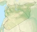
파일:Syria physical location map.svg

SVG 파일의 PNG 형식의 미리보기 크기: 685 × 599 픽셀. 다른 해상도: 274 × 240 픽셀 | 549 × 480 픽셀 | 878 × 768 픽셀 | 1,170 × 1,024 픽셀 | 2,340 × 2,048 픽셀 | 921 × 806 픽셀
원본 파일 (SVG 파일, 실제 크기 921 × 806 픽셀, 파일 크기: 972 KB)
파일 역사
날짜/시간 링크를 클릭하면 해당 시간의 파일을 볼 수 있습니다.
| 날짜/시간 | 섬네일 | 크기 | 사용자 | 설명 | |
|---|---|---|---|---|---|
| 현재 | 2022년 11월 18일 (금) 23:07 |  | 921 × 806 (972 KB) | GrandEscogriffe | more correct N/S stretching |
| 2012년 7월 24일 (화) 05:40 |  | 921 × 761 (788 KB) | NordNordWest | == {{int:filedesc}} == {{Information |Description={{de|Physische Positionskarte von Syrien. De-facto-Situation.}} Quadratische Plattkarte, N-S-Streckung 115 %. Geographische Begrenzung der Karte: * N: 37.6° N * S: 32.0° N * W: 34.9... |
이 파일을 사용하는 문서
다음 문서 9개가 이 파일을 사용하고 있습니다:
이 파일을 사용하고 있는 모든 위키의 문서 목록
다음 위키에서 이 파일을 사용하고 있습니다:
- als.wikipedia.org에서 이 파일을 사용하고 있는 문서 목록
- ar.wikipedia.org에서 이 파일을 사용하고 있는 문서 목록
- نهر السن
- بلودان
- الزبداني
- قالب:خريطة مواقع سوريا
- زلزال حلب (1138)
- بحيرة زرزر
- بحيرة قطينة
- مضايا
- زلزال حماة 1157
- وحدة:Location map/data/Syria
- مستخدم:عبد المؤمن/مسودات/خرائط/الشام
- قائمة الصحفيين القتلى في سوريا
- وحدة:Location map/data/Syria/شرح
- الشعيطات
- الخط الزمني للحرب الأهلية السورية (سبتمبر–ديسمبر 2019)
- الخط الزمني للحرب الأهلية السورية (يناير–أبريل 2020)
- الأغاني الحورية
- رقية حسن محمد
- الانتخابات المحلية في الإدارة الذاتية لشمال وشرق سوريا 2015
- الخط الزمني للحرب الأهلية السورية (2022)
- زلزال قهرمان مرعش 2023
- زلزال حلب 1822
- زلزال سوريا 1170
- زلزال سوريا 1344
- زلزال اللاذقية 1796
- زلزال سوريا 1202
- زلزال الساحل السوري 859
- زلزال أنطاكية 526
- زلزال أميك 1872
- arz.wikipedia.org에서 이 파일을 사용하고 있는 문서 목록
- ast.wikipedia.org에서 이 파일을 사용하고 있는 문서 목록
- av.wikipedia.org에서 이 파일을 사용하고 있는 문서 목록
- azb.wikipedia.org에서 이 파일을 사용하고 있는 문서 목록
이 파일의 더 많은 사용 내역을 봅니다.
