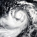
파일:Dianmu 2004-06-16 0415Z.jpg

미리 보기 크기: 457 × 600 픽셀 다른 해상도: 183 × 240 픽셀 | 366 × 480 픽셀 | 585 × 768 픽셀 | 780 × 1,024 픽셀 | 1,560 × 2,048 픽셀 | 6,401 × 8,401 픽셀
원본 파일 (6,401 × 8,401 픽셀, 파일 크기: 6.38 MB, MIME 종류: image/jpeg)
파일 역사
날짜/시간 링크를 클릭하면 해당 시간의 파일을 볼 수 있습니다.
| 날짜/시간 | 섬네일 | 크기 | 사용자 | 설명 | |
|---|---|---|---|---|---|
| 현재 | 2018년 12월 6일 (목) 01:33 |  | 6,401 × 8,401 (6.38 MB) | FleurDeOdile | worldview |
| 2014년 1월월 3일 (금) 05:24 |  | 5,000 × 5,000 (14.52 MB) | TheAustinMan | Color restoration based on MODIS images | |
| 2006년 9월 5일 (화) 07:51 |  | 5,000 × 5,000 (2.77 MB) | Good kitty | higher res... | |
| 2006년 7월 26일 (수) 16:47 |  | 1,600 × 1,600 (1.34 MB) | Irfanfaiz | ||
| 2006년 7월 26일 (수) 16:25 |  | 5,000 × 5,000 (3.06 MB) | Irfanfaiz | {{Information |Description=The MODIS instrument onboard NASA's Aqua satellite captured this true-color image of w:Super Typhoon Dianmu on w:June 16, w:2004 at 4:15 UTC. At the time this image was taken, Dianmu was located approximately 950 mil |
이 파일을 사용하는 문서
다음 문서 1개가 이 파일을 사용하고 있습니다:
이 파일을 사용하고 있는 모든 위키의 문서 목록
다음 위키에서 이 파일을 사용하고 있습니다:
- en.wikipedia.org에서 이 파일을 사용하고 있는 문서 목록
- pt.wikipedia.org에서 이 파일을 사용하고 있는 문서 목록
- th.wikipedia.org에서 이 파일을 사용하고 있는 문서 목록
- vi.wikipedia.org에서 이 파일을 사용하고 있는 문서 목록
- www.wikidata.org에서 이 파일을 사용하고 있는 문서 목록
- zh.wikipedia.org에서 이 파일을 사용하고 있는 문서 목록

