파일:Wales Carmarthenshire locator map.svg

SVG 파일의 PNG 형식의 미리보기 크기: 502 × 600 픽셀. 다른 해상도: 201 × 240 픽셀 | 402 × 480 픽셀 | 643 × 768 픽셀 | 857 × 1,024 픽셀 | 1,714 × 2,048 픽셀 | 1,047 × 1,251 픽셀
원본 파일 (SVG 파일, 실제 크기 1,047 × 1,251 픽셀, 파일 크기: 151 KB)
파일 설명
| 설명 |
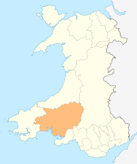
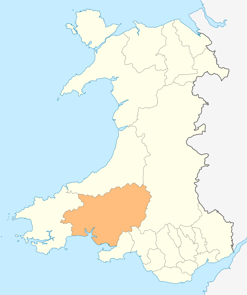
Deutsch: Lagekarte von Carmarthenshire in Wales
English: Locator map of Carmarthenshire in Wales |
| 날짜 | |
| 출처 | 자작 |
| 저자 | NordNordWest |
| 저작권 (이 파일을 인용하기) |
나는 아래 작품의 저작권자로서, 이 저작물을 다음과 같은 라이선스로 배포합니다: 이 파일은 크리에이티브 커먼즈 저작자표시-동일조건변경허락 3.0 Unported 라이선스로 배포됩니다.
|

|
This map has been made or improved in the German Kartenwerkstatt (Map Lab). You can propose maps to improve as well.
|
파일 역사
날짜/시간 링크를 클릭하면 해당 시간의 파일을 볼 수 있습니다.
| 날짜/시간 | 섬네일 | 크기 | 사용자 | 설명 | |
|---|---|---|---|---|---|
| 현재 | 2010년 5월 5일 (수) 03:49 | | 1,047 × 1,251 (151 KB) | NordNordWest | {{int:filedesc}} {{Information |Description= {{de|Lagekarte von Carmarthenshire in Wales}} {{en|Locator map of Carmarthenshire in Wales}} |Source={{Own}} |Date=2010-05-04 |Author={{U|NordNordWest}} |Permission={{self|cc-by-sa-3.0}} |other_versions= }} {{ |
이 파일을 사용하는 문서
다음 문서 1개가 이 파일을 사용하고 있습니다:
이 파일을 사용하고 있는 모든 위키의 문서 목록
다음 위키에서 이 파일을 사용하고 있습니다:
- cs.wikipedia.org에서 이 파일을 사용하고 있는 문서 목록
- de.wikipedia.org에서 이 파일을 사용하고 있는 문서 목록
- en.wikipedia.org에서 이 파일을 사용하고 있는 문서 목록
- WWT Llanelli Wetlands Centre
- Carmarthenshire
- Sandy, Carmarthenshire
- Llanelli
- Carmarthen
- Llandeilo
- Newcastle Emlyn
- Whitland
- Burry Port
- Kidwelly
- Llandovery
- Laugharne
- St Clears
- Pendine
- Garreg Lwyd (Black Mountain)
- Llandybie
- Llanwrda
- Afon Cothi
- Cwmann
- Bancyfelin
- Talley
- Aber-arad
- Aber-giar
- Abergorlech
- Abernant, Carmarthenshire
- Cross Hands
- Pantyffynnon
- List of places in Carmarthenshire
- Brandy Hill, Wales
- Caio, Carmarthenshire
- Template:Carmarthenshire-geo-stub
- Bryn, Llanelli
- Pemberton, Carmarthenshire
- Dafen, Carmarthenshire
- Pendine Museum of Speed
- Usk Reservoir
- River Cywyn
- Five Roads
- Maesybont
- Glanymor
- Trefawr Track
- Bethlehem, Carmarthenshire
- Stradey
- Cross Inn
- Bronwydd
- Llanfihangel Rhos-y-Corn
- St Ishmael, Carmarthenshire
- Elvet Hundred
이 파일의 더 많은 사용 내역을 봅니다.