사용자:배우는사람/틀:Anglosphere image map
|
 |
사용 예
편집- 기본값의 경우: 그림이 가운데에 정렬로 표시된다.
{{사용자:배우는사람/틀:Anglosphere image map}}
|
|
- 섬네일 형식인 경우: 섬네일이 가운데에 표시된다
{{사용자:배우는사람/틀:Anglosphere image map|thumb=1}}
|
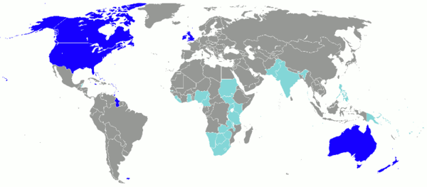
Dark blue: Countries and territories where English is spoken natively by a significant population. Light blue: Countries where English is an official language but less widely spoken. |
- 그림으로 오른쪽에 테두리선과 함께 표시
{{사용자:배우는사람/틀:Anglosphere image map|float=right|border=1}}
|
|
- 그림으로 오른쪽에 테두리선과 함께 표시
{{사용자:배우는사람/틀:Anglosphere image map|float=right|border=1|hidenavbar=1}}
|
|
- 섬네일 형식으로 오른쪽에 표시
{{사용자:배우는사람/틀:Anglosphere image map|thumb=1|float=right}}
|
Dark blue: Countries and territories where English is spoken natively by a significant population. Light blue: Countries where English is an official language but less widely spoken. |