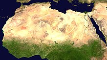
파일:Africa satellite plane.jpg

미리 보기 크기: 570 × 600 픽셀 다른 해상도: 228 × 240 픽셀 | 456 × 480 픽셀 | 730 × 768 픽셀 | 973 × 1,024 픽셀 | 1,947 × 2,048 픽셀 | 8,460 × 8,900 픽셀
원본 파일 (8,460 × 8,900 픽셀, 파일 크기: 7.34 MB, MIME 종류: image/jpeg)
파일 역사
날짜/시간 링크를 클릭하면 해당 시간의 파일을 볼 수 있습니다.
| 날짜/시간 | 섬네일 | 크기 | 사용자 | 설명 | |
|---|---|---|---|---|---|
| 현재 | 2005년 3월 28일 (월) 09:46 |  | 8,460 × 8,900 (7.34 MB) | Dbenbenn | original high-resolution version, cropped land_shallow_topo_west.tif at 8460x8900+19400+6200 |
| 2004년 11월 14일 (일) 06:08 |  | 741 × 800 (113 KB) | Bjarki S |
이 파일을 사용하는 문서
이 파일을 사용하는 문서가 없습니다.
이 파일을 사용하고 있는 모든 위키의 문서 목록
다음 위키에서 이 파일을 사용하고 있습니다:
- ace.wikipedia.org에서 이 파일을 사용하고 있는 문서 목록
- af.wikipedia.org에서 이 파일을 사용하고 있는 문서 목록
- als.wikipedia.org에서 이 파일을 사용하고 있는 문서 목록
- ar.wikipedia.org에서 이 파일을 사용하고 있는 문서 목록
- ar.wikinews.org에서 이 파일을 사용하고 있는 문서 목록
- ast.wikipedia.org에서 이 파일을 사용하고 있는 문서 목록
- azb.wikipedia.org에서 이 파일을 사용하고 있는 문서 목록
- az.wikipedia.org에서 이 파일을 사용하고 있는 문서 목록
- az.wikiquote.org에서 이 파일을 사용하고 있는 문서 목록
- ba.wikipedia.org에서 이 파일을 사용하고 있는 문서 목록
- be.wikipedia.org에서 이 파일을 사용하고 있는 문서 목록
- bm.wikipedia.org에서 이 파일을 사용하고 있는 문서 목록
- ca.wikiquote.org에서 이 파일을 사용하고 있는 문서 목록
- cdo.wikipedia.org에서 이 파일을 사용하고 있는 문서 목록
- co.wikipedia.org에서 이 파일을 사용하고 있는 문서 목록
- cv.wikipedia.org에서 이 파일을 사용하고 있는 문서 목록
- da.wikipedia.org에서 이 파일을 사용하고 있는 문서 목록
- de.wikipedia.org에서 이 파일을 사용하고 있는 문서 목록
- Oldowan
- CFA-Franc-Zone
- Fußball in Südafrika
- Portal:Afrika
- Wikipedia:Archiv/Qualitätsoffensive/Afrika
- Wikipedia:WikiProjekt Afrika
- Wikipedia Diskussion:WikiProjekt Afrika
- Uganda Olympic Committee
- Wikipedia:WikiProjekt Sudan
- Portal:Afrika/Unsere besten Artikel
- Wikipedia:WikiProjekt Äthiopien
- Portal:Gambia
- Fußball in Äthiopien
- Wikipedia:WikiProjekt Sudan/Verwandte
- Portal:Afrika/Register
- Benutzer:Vorlage/Herkunftsvorlagen
- Portal:Hip-Hop
- Portal:Hip-Hop/Hip-Hop nach Ländern
- Namibia National Olympic Committee
- Fußball
- Benutzer:Heiteck
- Benutzer:Vorlage/aus Afrika
- Gambia National Olympic Committee
- Portal:Nigeria
- Fußball in Lesotho
- Fußball in Burkina Faso
이 파일의 더 많은 사용 내역을 봅니다.


