파일:Bilten GL SBB.jpeg

미리 보기 크기: 800 × 533 픽셀 다른 해상도: 320 × 213 픽셀 | 640 × 427 픽셀 | 1,024 × 683 픽셀 | 1,280 × 853 픽셀 | 2,560 × 1,706 픽셀 | 5,200 × 3,466 픽셀
원본 파일 (5,200 × 3,466 픽셀, 파일 크기: 7.3 MB, MIME 종류: image/jpeg)
파일 설명
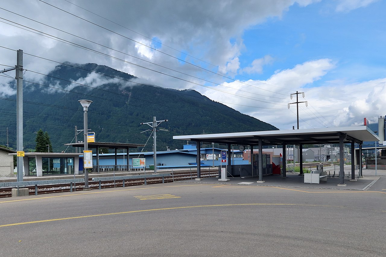
| 설명 | Bilten was connected to the Nordostbahn railway network in 1875. The old train station was demolished in 2011 and today's facilities were built. But there are no buildings except the signal box, just two new shelters. In terms of signal box technology (Thales Elektra2), Bilten is considered a train station. The central platform has existed since 1950. The first shelter on the platform (left) was built a short time later. But we live in fast moving times and train stations are no longer built to last a hundred years. Bilten station will be closed no later than 2027, only 15 years since the renovation. Maybe already earlier, and dismantled. The reason for this is a new passing track in Siebnen that is being built on this main line of Zurich-Chur. Already today only a few trains stop here. They were replaced by buses. |
| 날짜 | |
| 출처 | SBB Station - Bilten GL (Intro) |
| 저자 | Kecko from Eastern Switzerland |
| 카메라 위치 | | 이 지역의 다른 사진을 보기: OpenStreetMap |
|---|
라이선스
이 파일은 크리에이티브 커먼즈 저작자표시 2.0 일반 라이선스로 배포됩니다.
- 이용자는 다음의 권리를 갖습니다:
- 공유 및 이용 – 저작물의 복제, 배포, 전시, 공연 및 공중송신
- 재창작 – 저작물의 개작, 수정, 2차적저작물 창작
- 다음과 같은 조건을 따라야 합니다:
- 저작자표시 – 적절한 저작자 표시를 제공하고, 라이센스에 대한 링크를 제공하고, 변경사항이 있는지를 표시해야 합니다. 당신은 합리적인 방식으로 표시할 수 있지만, 어떤 방식으로든 사용권 허가자가 당신 또는 당신의 사용을 지지하는 방식으로 표시할 수 없습니다.
| 이 이미지는 https://flickr.com/photos/70981241@N00/51320472384 에서 Kecko에 의하여 플리커에 처음 게시되었습니다. 이것을 FlickreviewR 2 로봇이 검토하였고, cc-by-2.0의 조건에 따른 라이선스임을 확인하였습니다. |
파일 역사
날짜/시간 링크를 클릭하면 해당 시간의 파일을 볼 수 있습니다.
| 날짜/시간 | 섬네일 | 크기 | 사용자 | 설명 | |
|---|---|---|---|---|---|
| 현재 | 2021년 7월 22일 (목) 16:18 | | 5,200 × 3,466 (7.3 MB) | 1-Byte | Transferred from Flickr via #flickr2commons |
이 파일을 사용하는 문서
다음 문서 1개가 이 파일을 사용하고 있습니다:
이 파일을 사용하고 있는 모든 위키의 문서 목록
다음 위키에서 이 파일을 사용하고 있습니다:
- arz.wikipedia.org에서 이 파일을 사용하고 있는 문서 목록
- de.wikipedia.org에서 이 파일을 사용하고 있는 문서 목록
- en.wikipedia.org에서 이 파일을 사용하고 있는 문서 목록
- es.wikipedia.org에서 이 파일을 사용하고 있는 문서 목록
- sv.wikipedia.org에서 이 파일을 사용하고 있는 문서 목록
- www.wikidata.org에서 이 파일을 사용하고 있는 문서 목록