파일:Derbyshire UK location map.svg

SVG 파일의 PNG 형식의 미리보기 크기: 406 × 599 픽셀. 다른 해상도: 162 × 240 픽셀 | 325 × 480 픽셀 | 520 × 768 픽셀 | 693 × 1,024 픽셀 | 1,387 × 2,048 픽셀 | 884 × 1,305 픽셀
원본 파일 (SVG 파일, 실제 크기 884 × 1,305 픽셀, 파일 크기: 2.38 MB)
| 설명 |
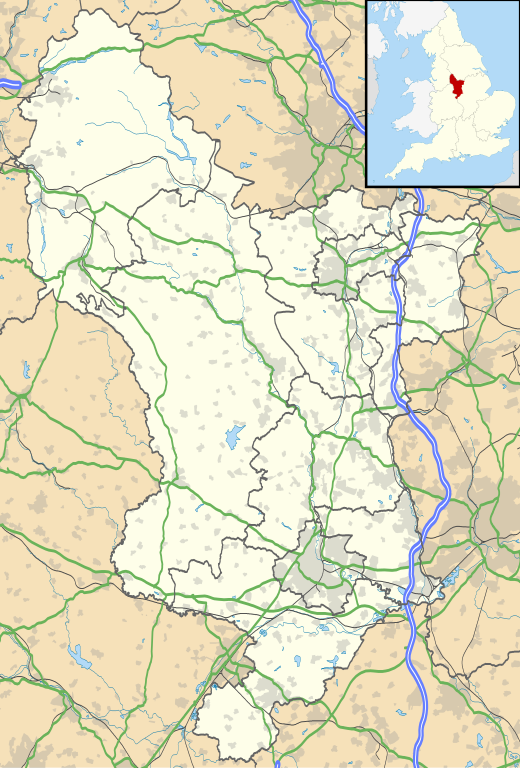
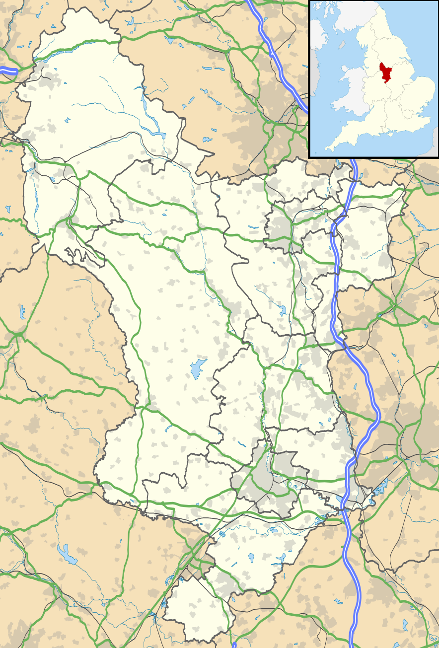
Map of Derbyshire, UK with the following information shown:
Equirectangular map projection on WGS 84 datum, with N/S stretched 165% Geographic limits:
|
| 날짜 | |
| 출처 |
|
| 저자 | Nilfanion, created using Ordnance Survey data |
| 저작권 (이 파일을 인용하기) |
이 파일은 크리에이티브 커먼즈 저작자표시-동일조건변경허락 3.0 Unported 라이선스로 배포됩니다. 저작자표시: Contains Ordnance Survey data © Crown copyright and database right
|
| 다른 버전 | File:Devon UK district map (blank).svg - Blank map |
.svg)
파일 역사
날짜/시간 링크를 클릭하면 해당 시간의 파일을 볼 수 있습니다.
| 날짜/시간 | 섬네일 | 크기 | 사용자 | 설명 | |
|---|---|---|---|---|---|
| 현재 | 2010년 9월 27일 (월) 03:46 | | 884 × 1,305 (2.38 MB) | Nilfanion | {{Information |Description=Map of Derbyshire, UK with the following information shown: *Administrative borders *Coastline, lakes and rivers *Roads and railways *Urban areas Equirectangular map projection on WGS 84 datum, with N/S stretch |
이 파일을 사용하는 문서
다음 문서 1개가 이 파일을 사용하고 있습니다:
이 파일을 사용하고 있는 모든 위키의 문서 목록
다음 위키에서 이 파일을 사용하고 있습니다:
- ar.wikipedia.org에서 이 파일을 사용하고 있는 문서 목록
- bg.wikipedia.org에서 이 파일을 사용하고 있는 문서 목록
- ca.wikipedia.org에서 이 파일을 사용하고 있는 문서 목록
- ceb.wikipedia.org에서 이 파일을 사용하고 있는 문서 목록
- cs.wikipedia.org에서 이 파일을 사용하고 있는 문서 목록
- cy.wikipedia.org에서 이 파일을 사용하고 있는 문서 목록
- el.wikipedia.org에서 이 파일을 사용하고 있는 문서 목록
- en.wikipedia.org에서 이 파일을 사용하고 있는 문서 목록
- Derbyshire
- Chatsworth House
- Kedleston Hall
- Staveley, Derbyshire
- Glossop
- Buxton
- Calke Abbey
- Sudbury Hall
- Bolsover Castle
- Chesterfield, Derbyshire
- Thornhill, Derbyshire
- Newhaven, Derbyshire
- Gamesley
- Bretby Hall
- Birchinlee
- Ripley, Derbyshire
- Repton
- Eyam
- Edale
- Castleton, Derbyshire
- Hope, Derbyshire
- Hathersage
- Spondon
- Matlock, Derbyshire
- Matlock Bath
- Bolsover
- Ashbourne, Derbyshire
- Alfreton
- Heanor
- Pleasley
- Wirksworth
- Leam, Derbyshire
- Ilkeston
- Heage
- New Mills
- Long Eaton
- Littleover
- Mickleover
- Dronfield
- Tideswell
- Hartington, Derbyshire
이 파일의 더 많은 사용 내역을 봅니다.