파일:GreensboroColiseumnasa.png

미리 보기 크기: 800 × 527 픽셀 다른 해상도: 320 × 211 픽셀 | 640 × 421 픽셀 | 992 × 653 픽셀
원본 파일 (992 × 653 픽셀, 파일 크기: 1.22 MB, MIME 종류: image/png)
| 설명 |
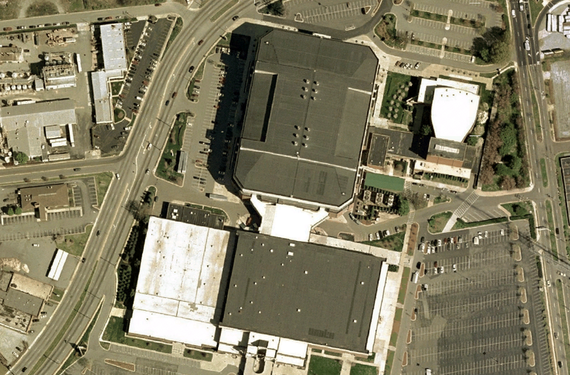
English: Greensboro Coliseum, North Carolina. Satellite view. |
|||
| 날짜 | 2007년 6월 14일 (원본 올리기 일시) | |||
| 출처 | Satellite imagery taken from NASA World Wind software version 1.3.5 (by screenshot) | |||
| 저자 | NASA/USGS | |||
| 저작권 (이 파일을 인용하기) |
|

기존 올리기 기록
The original description page was here. All following user names refer to fr.wikipedia.
- 2007-06-14 14:42 Betp 992×653×8 (1276545 bytes) Image USGS Urban Area de Greensboro prise sur nasa world wind 1.3.5
파일 역사
날짜/시간 링크를 클릭하면 해당 시간의 파일을 볼 수 있습니다.
| 날짜/시간 | 섬네일 | 크기 | 사용자 | 설명 | |
|---|---|---|---|---|---|
| 현재 | 2007년 6월 14일 (목) 23:46 | | 992 × 653 (1.22 MB) | Betp | {{Information |Description=Image USGS Urban Area de Greensboro prise sur nasa world wind 1.3.5 |Source=Originally from [http://fr.wikipedia.org fr.wikipedia]; description page is/was [http://fr.wikipedia.org/w/index.php?title=Image%3AGreensboroColiseumsat |
이 파일을 사용하는 문서
다음 문서 1개가 이 파일을 사용하고 있습니다:
이 파일을 사용하고 있는 모든 위키의 문서 목록
다음 위키에서 이 파일을 사용하고 있습니다:
- de.wikipedia.org에서 이 파일을 사용하고 있는 문서 목록
- en.wikipedia.org에서 이 파일을 사용하고 있는 문서 목록
- fa.wikipedia.org에서 이 파일을 사용하고 있는 문서 목록
- fr.wikipedia.org에서 이 파일을 사용하고 있는 문서 목록
- pt.wikipedia.org에서 이 파일을 사용하고 있는 문서 목록
- www.wikidata.org에서 이 파일을 사용하고 있는 문서 목록