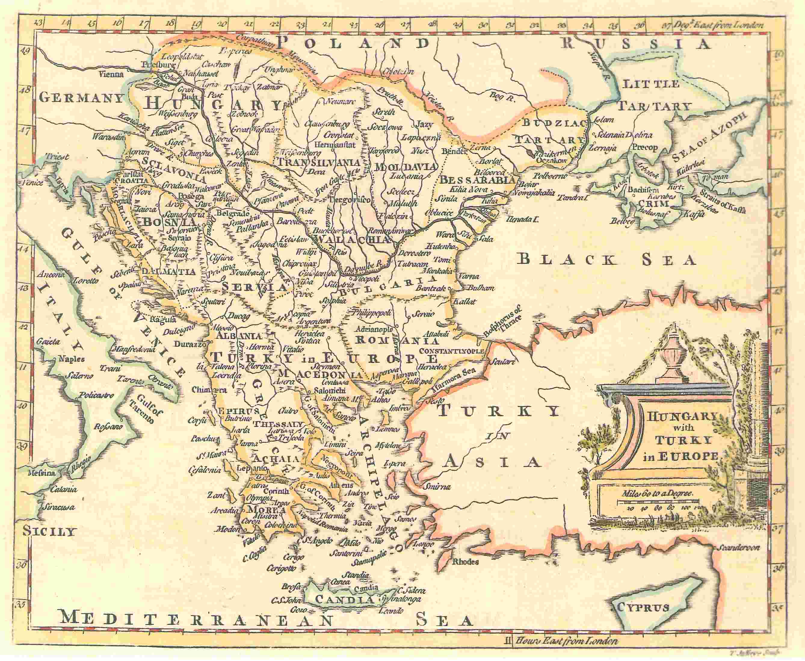
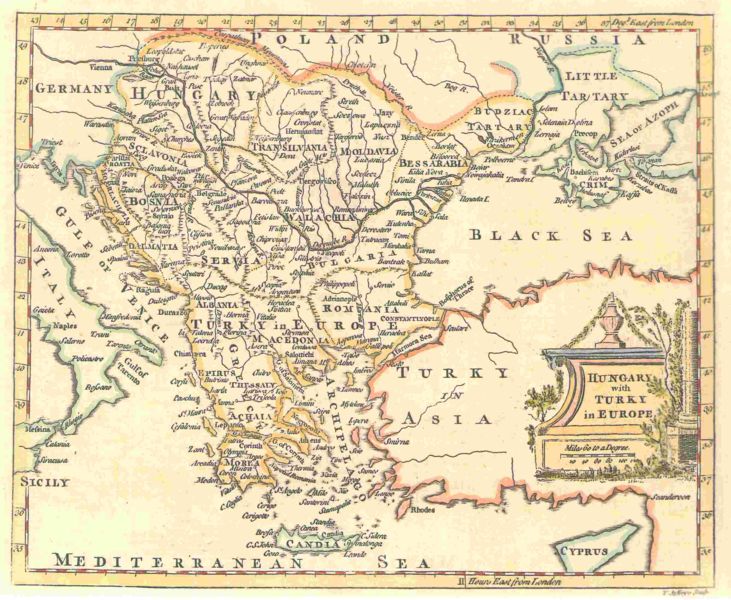
The map shows Hungary and the bordering Balkan regions controlled by the Ottoman Empire.
The owner of the map agrees to the image being displayed in Wikipedia. All other ways of using this image should be disussed with User:KIDB
Public domainPublic domainfalsefalse
이 작품은 미국, 그리고 저작권 보호 기간이 저작자 사후 70년, 또는 그 이하인 모든 국가에서 퍼블릭 도메인입니다.
You must also include a United States public domain tag to indicate why this work is in the public domain in the United States. 일부 국가는 저작권을 사후 70년보다 더 길게 적용하고 있으므로 주의가 필요합니다. 멕시코는 100년, 자메이카는 95년, 콜롬비아는 80년, 과테말라와 사모아는 75년을 저작권 보호 기간으로 적용하고 있습니다. 따라서 해당 국가에서 이 작품은 퍼블릭 도메인이 아닐 수 있으며, 저작권 상호주의 또한 적용되지 않을 수 있습니다.
https://creativecommons.org/publicdomain/mark/1.0/PDMCreative Commons Public Domain Mark 1.0falsefalse
This image was uploaded in the JPEG format even though it consists of non-photographic data. This information could be stored more efficiently or accurately in the PNG or SVG format. If possible, please upload a PNG or SVG version of this image without compression artifacts, derived from a non-JPEG source (or with existing artifacts removed). After doing so, please tag the JPEG version with {{Superseded|NewImage.ext}} and remove this tag. This tag should not be applied to photographs or scans. If this image is a diagram or other image suitable for vectorisation, please tag this image with {{Convert to SVG}} instead of {{BadJPEG}}. If not suitable for vectorisation, use {{Convert to PNG}}. For more information, see {{BadJPEG}}.
'''A map by T. Jefferys, 1785''' <br><br> The map shows Hungary and the bordering Balkan regions controlled by the Ottoman Empire. <br><br> ''The owner of the map agrees to the image being displayed in Wikipedia. All other ways of using this image should


