파일:Kentucky counties map.png

미리 보기 크기: 800 × 387 픽셀 다른 해상도: 320 × 155 픽셀 | 640 × 310 픽셀 | 1,153 × 558 픽셀
원본 파일 (1,153 × 558 픽셀, 파일 크기: 112 KB, MIME 종류: image/png)
파일 설명
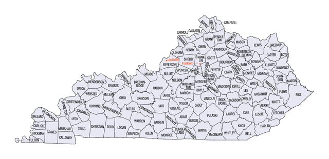
Map of Kentucky counties from http://quickfacts.census.gov/qfd/maps/kentucky_map.html Archived 2013-03-01 at Wikiwix
라이선스
This image or file is a work of a United States Census Bureau employee, taken or made as part of that person's official duties. As a work of the U.S. federal government, the image is in the public domain.
|
 |
파일 역사
날짜/시간 링크를 클릭하면 해당 시간의 파일을 볼 수 있습니다.
| 날짜/시간 | 섬네일 | 크기 | 사용자 | 설명 | |
|---|---|---|---|---|---|
| 현재 | 2009년 1월 18일 (일) 03:36 | | 1,153 × 558 (112 KB) | Nyttend | == Summary == Map of Kentucky counties from http://quickfacts.census.gov/qfd/maps/kentucky_map.html == Licensing == {{PD-USGov-DOC-Census}} Category:Maps of Kentucky <!--{{ImageUpload|basic}}--> |
이 파일을 사용하는 문서
다음 문서 1개가 이 파일을 사용하고 있습니다:
이 파일을 사용하고 있는 모든 위키의 문서 목록
다음 위키에서 이 파일을 사용하고 있습니다:
- ar.wikipedia.org에서 이 파일을 사용하고 있는 문서 목록
- cy.wikipedia.org에서 이 파일을 사용하고 있는 문서 목록
- en.wikipedia.org에서 이 파일을 사용하고 있는 문서 목록
- List of counties in Kentucky
- National Register of Historic Places listings in Kentucky
- User:TonyTheTiger/List of the Day/Nominees/200803
- Wikipedia:List of the day/March 2008
- Index of Kentucky-related articles
- Outline of Kentucky
- User:Acdixon/Government of Kentucky
- List of metropolitan areas of Kentucky
- es.wikipedia.org에서 이 파일을 사용하고 있는 문서 목록
- fa.wikipedia.org에서 이 파일을 사용하고 있는 문서 목록
- fr.wikipedia.org에서 이 파일을 사용하고 있는 문서 목록
- he.wikipedia.org에서 이 파일을 사용하고 있는 문서 목록
- hu.wikipedia.org에서 이 파일을 사용하고 있는 문서 목록
- hu.wiktionary.org에서 이 파일을 사용하고 있는 문서 목록
- it.wikipedia.org에서 이 파일을 사용하고 있는 문서 목록
- ja.wikipedia.org에서 이 파일을 사용하고 있는 문서 목록
- lg.wikipedia.org에서 이 파일을 사용하고 있는 문서 목록
- Template:Amagombolola g’e Kentucky
- Adair County, Kentucky
- Allen County, Kentucky
- Anderson County,Kentucky
- Ballard County, Kentucky
- Bath County, Kentucky
- Harrison County, Kentucky
- Bracken County, Kentucky
- Grayson County, Kentucky
- Cumberland County, Kentucky
- Crittenden County, Kentucky
- Bullitt County, Kentucky
- Butler County, Kentucky
- Caldwell County, Kentucky
- Calloway County, Kentucky
- Campbell County, Kentucky
- Boone County, Kentucky
- Bell County, Kentucky
- Bourbon County, Kentucky
- Fleming County, Kentucky
- Casey County, Kentucky
- Greenup County, Kentucky
- Edmonson County, Kentucky
- Daviess County, Kentucky
- McCracken County, Kentucky
- Carroll County, Kentucky
- Boyd County, Kentucky
- Boyle County, Kentucky
- Breathitt County, Kentucky
이 파일의 더 많은 사용 내역을 봅니다.