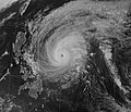
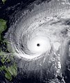
파일:Mitag 2002-03-05 1400Z.jpg

미리 보기 크기: 506 × 599 픽셀 다른 해상도: 203 × 240 픽셀 | 405 × 480 픽셀 | 648 × 768 픽셀 | 864 × 1,024 픽셀 | 1,729 × 2,048 픽셀 | 3,492 × 4,137 픽셀
원본 파일 (3,492 × 4,137 픽셀, 파일 크기: 4.97 MB, MIME 종류: image/jpeg)
파일 역사
날짜/시간 링크를 클릭하면 해당 시간의 파일을 볼 수 있습니다.
| 날짜/시간 | 섬네일 | 크기 | 사용자 | 설명 | |
|---|---|---|---|---|---|
| 현재 | 2022년 12월 2일 (금) 00:46 |  | 3,492 × 4,137 (4.97 MB) | TheWxResearcher | Reverted to version as of 14:30, 1 December 2022 (UTC) Noru please upload your file separately I don't want to give you a warning since you're a good editor, but nobody is trying to get involved in a edit war. Like I said that image wasn't taken at 1400 UTC on 3/5/02 and the reason why I know your image wasn't taken 1400 UTC is because it's nighttime in West Pacific at 1400 UTC and IR images are taken at nighttime, also it's poor in quality like Luis said. |
| 2022년 12월 1일 (목) 23:45 |  | 589 × 507 (67 KB) | SuperTyphoonNoru | Looks like a computer generated typhoon, the eyes are too big, no other wind | |
| 2022년 12월 1일 (목) 23:30 |  | 3,492 × 4,137 (4.97 MB) | JCMLuis | Reverted to version as of 16:12, 29 November 2022 (UTC) Please stop reverting it back to your file and upload it separately like Cyclone said. You have no real reason to and you can't just say it looks fake. | |
| 2022년 12월 1일 (목) 19:43 |  | 589 × 507 (67 KB) | SuperTyphoonNoru | How did you know? | |
| 2022년 11월 30일 (수) 01:12 |  | 3,492 × 4,137 (4.97 MB) | TheWxResearcher | Reverted to version as of 22:44, 28 November 2022 (UTC) Please upload your image separately that image your trying to use wasn't even taken at 14:00 UTC on March 5, 2002. | |
| 2022년 11월 29일 (화) 16:21 |  | 589 × 507 (67 KB) | SuperTyphoonNoru | its too cgi + its fake | |
| 2022년 11월 29일 (화) 07:44 |  | 3,492 × 4,137 (4.97 MB) | JCMLuis | Reverted to version as of 17:16, 24 April 2018 (UTC) This isn't really any better. Low quality, not colorful, and does not seem to go with the source. The grid and coastline outline is not needed as well in satellite images. | |
| 2022년 11월 28일 (월) 16:12 |  | 589 × 507 (67 KB) | SuperTyphoonNoru | the first picture looks so fake. | |
| 2018년 4월 25일 (수) 02:16 |  | 3,492 × 4,137 (4.97 MB) | FleurDeOdile | User created page with UploadWizard |
이 파일을 사용하는 문서
다음 문서 3개가 이 파일을 사용하고 있습니다:
이 파일을 사용하고 있는 모든 위키의 문서 목록
다음 위키에서 이 파일을 사용하고 있습니다:
- en.wikipedia.org에서 이 파일을 사용하고 있는 문서 목록
- es.wikipedia.org에서 이 파일을 사용하고 있는 문서 목록
- ja.wikipedia.org에서 이 파일을 사용하고 있는 문서 목록
- pt.wikipedia.org에서 이 파일을 사용하고 있는 문서 목록
- th.wikipedia.org에서 이 파일을 사용하고 있는 문서 목록
- vi.wikipedia.org에서 이 파일을 사용하고 있는 문서 목록
- www.wikidata.org에서 이 파일을 사용하고 있는 문서 목록
- zh.wikipedia.org에서 이 파일을 사용하고 있는 문서 목록

