파일:NZ-Northland plain map2.png
최대 해상도입니다.
NZ-Northland_plain_map2.png (378 × 423 픽셀, 파일 크기: 12 KB, MIME 종류: image/png)

|
이 그림 파일은 벡터 SVG 형식으로 다시 만들어야 합니다. SVG의 장점에 대해서는 여기(영어)를 참고해 주십시오. 만약 이 그림의 SVG 버전이 이미 존재한다면 이 틀을 {{vector version available|새 파일 이름.svg}}으로 대체해 주십시오.
|
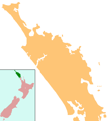
파일 설명
| 설명 | Locator map for Northland, New Zealand |
| 날짜 | |
| 출처 | combination of Image:NZ-NI plain map.png and Image:Position of Northland.png |
| 저자 | Grutness, based on work by User:Gadfium |
| 저작권 (이 파일을 인용하기) |
public domain. Copied from en:Image:NZ-Northland plain map2.png |
| 다른 버전 | Earlier version is at Image:NZ-Northland_plain_map.png |
라이선스
| 이 작품은 저작자인 Grutness에 의해 퍼블릭 도메인으로 공개된 작품입니다. 이 공개 선언은 전 세계적으로 유효합니다. 만약 저작권의 포기가 법률적으로 가능하지 않은 경우, |
파일 역사
날짜/시간 링크를 클릭하면 해당 시간의 파일을 볼 수 있습니다.
| 날짜/시간 | 섬네일 | 크기 | 사용자 | 설명 | |
|---|---|---|---|---|---|
| 현재 | 2008년 4월 17일 (목) 08:08 | | 378 × 423 (12 KB) | Gadfium | {{Information |Description=Locator map for Northland, New Zealand |Source=combination of Image:NZ-NI plain map.png and Image:Position of Northland.png |Date=17 March 2008 |Author=Grutness, based on work by User:Gadfium |Permission=public dom |
이 파일을 사용하는 문서
다음 문서 4개가 이 파일을 사용하고 있습니다:
이 파일을 사용하고 있는 모든 위키의 문서 목록
다음 위키에서 이 파일을 사용하고 있습니다:
- ar.wikipedia.org에서 이 파일을 사용하고 있는 문서 목록
- ceb.wikipedia.org에서 이 파일을 사용하고 있는 문서 목록
- en.wikipedia.org에서 이 파일을 사용하고 있는 문서 목록
- Whangārei
- Lake Ōmāpere
- Whangarei Airport
- Kaitaia Airport
- Rangiahua
- Kerikeri Airport
- List of schools in the Northland Region
- Taurikura
- Mount Manaia
- Mangamuka
- Matihetihe
- Omanaia
- Oromahoe
- Whirinaki, Northland
- Whangape Harbour
- Whangaroa Harbour
- Umawera
- Aranga, New Zealand
- Arapohue
- Kaihu
- Pouto Peninsula
- Module:Location map/data/New Zealand Northland/doc
- Kokopu, New Zealand
- Titoki, New Zealand
- Pakotai
- Poroti
- Purua
- Tauraroa
- Waiotira
- Whananaki
- Otiria
- Ōruawharo River
- Topuni River
- Bulrush Lake (Northland)
- Half Mile Lagoon
- Lake Half
- Lake Humuhumu
- Lake Kahuparere
- Lake Kaiwai
- Lake Kanono
- Lake Kapoai
- Lake Karaka
- Lake Karoro / Mathews
- Lake Kihona
- Lake Manuwai
- Lake Mokeno
이 파일의 더 많은 사용 내역을 봅니다.