파일:New South Wales locator-MJC.png
최대 해상도입니다.
New_South_Wales_locator-MJC.png (563 × 476 픽셀, 파일 크기: 12 KB, MIME 종류: image/png)

|
이 그림 파일은 벡터 SVG 형식으로 다시 만들어야 합니다. SVG의 장점에 대해서는 여기(영어)를 참고해 주십시오. 만약 이 그림의 SVG 버전이 이미 존재한다면 이 틀을 {{vector version available|새 파일 이름.svg}}으로 대체해 주십시오.
|
파일 설명
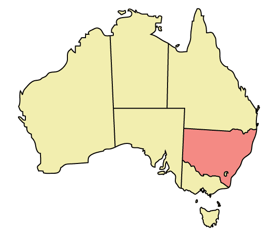
Map of Australia highlighting New South Wales
Made in Adobe Illustrator by Martynam and released under the GFDL
라이선스
| 이 파일은 크리에이티브 커먼즈 저작자표시-동일조건변경허락 3.0 Unported 라이선스로 배포됩니다. 면책 조항이 적용됩니다. | ||
| ||
| 이 라이선스 틀은 GFDL 라이선스 변경의 일부로 이 파일에 추가되었습니다. |

|
GNU 자유 문서 사용 허가서 1.2판 또는 자유 소프트웨어 재단에서 발행한 이후 판의 규정에 따라 본 문서를 복제하거나 개작 및 배포할 수 있습니다. 본 문서에는 변경 불가 부분이 없으며, 앞 표지 구절과 뒷 표지 구절도 없습니다. 본 사용 허가서의 전체 내용은 GNU 자유 문서 사용 허가서 부분에 포함되어 있습니다. 면책 조항이 적용됩니다. |
파일 역사
날짜/시간 링크를 클릭하면 해당 시간의 파일을 볼 수 있습니다.
| 날짜/시간 | 섬네일 | 크기 | 사용자 | 설명 | |
|---|---|---|---|---|---|
| 현재 | 2005년 12월 31일 (토) 07:48 | | 563 × 476 (12 KB) | Snowdog | Map of Australia highlighting New South Wales Made in Adobe Illustrator by Martynam and released under the GFDL Category:Maps of Australia |
이 파일을 사용하는 문서
다음 문서 1개가 이 파일을 사용하고 있습니다:
이 파일을 사용하고 있는 모든 위키의 문서 목록
다음 위키에서 이 파일을 사용하고 있습니다:
- ar.wikipedia.org에서 이 파일을 사용하고 있는 문서 목록
- ckb.wikipedia.org에서 이 파일을 사용하고 있는 문서 목록
- cs.wikipedia.org에서 이 파일을 사용하고 있는 문서 목록
- cy.wikipedia.org에서 이 파일을 사용하고 있는 문서 목록
- de.wikipedia.org에서 이 파일을 사용하고 있는 문서 목록
- en.wikipedia.org에서 이 파일을 사용하고 있는 문서 목록
- User:99of9
- User:Stixpjr
- User:Nomadtales
- East Richmond railway station, Sydney
- Penshurst railway station, Sydney
- Punchbowl railway station
- Narrandera Airport
- User:SamJohnston
- User:Martyman/My Images/Maps
- Glenreagh Mountain Railway
- User:Grogan deYobbo
- RAAF Base Glenbrook
- Dochra Airfield
- Allandale railway station, New South Wales
- Cemetery Station No. 3 railway station
- Cemetery Station No. 2 railway station
- Rookwood railway station, Sydney
- Ballina Byron Gateway Airport
- User:RuthlessOne
- Palm Beach Water Airport
- Broken Hill railway line
- Stroud Road railway station
- Transport Construction Authority
- Lismore Airport
- Broken Hill Airport
- Coonamble Airport
- Griffith Airport
- Lightning Ridge Airport
- Bourke Airport
- Cobar Airport
- Walgett Airport
- Merimbula Airport
- Narrabri Airport
- Parkes Airport
- West Wyalong Airport
- Clyburn railway station
- Delec Platform railway station
- Hope Street Platform railway station
- Enfield South Platform railway station
- Cochrane railway station, Sydney
- Oaklands railway line, New South Wales
- Hay railway line
- Rankins Springs railway line
- Burcher railway line
- Tocumwal railway line, New South Wales
이 파일의 더 많은 사용 내역을 봅니다.