파일:Portsmouth Semaphore Tower.jpg
원본 파일 (4,288 × 3,216 픽셀, 파일 크기: 3.41 MB, MIME 종류: image/jpeg)
파일 설명
| 설명 |
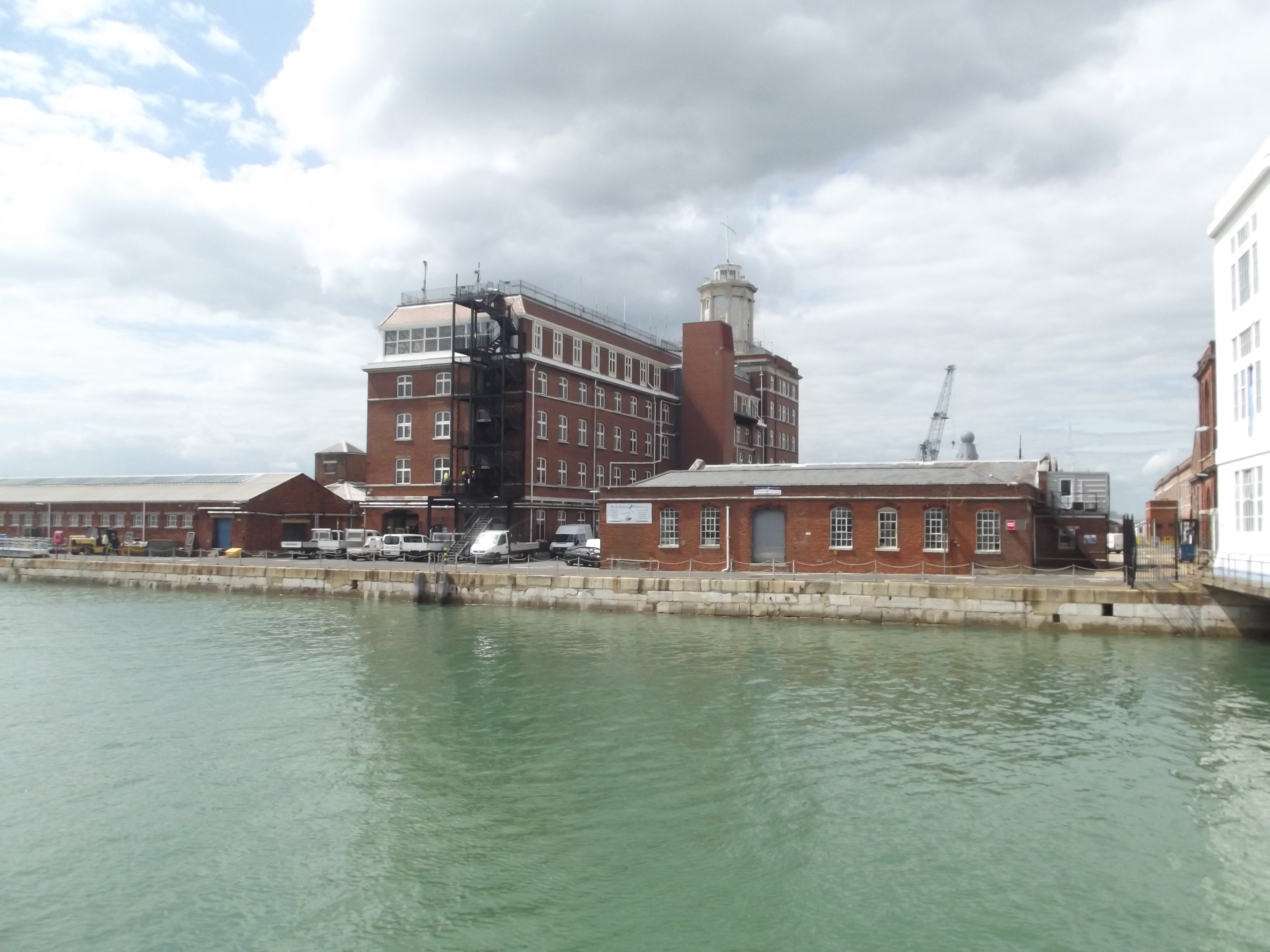
English: Heading to the Dockyard Pier to get on the boat for Harbour Tours at Portsmouth Historic Dockyard.
View of the The Lion Gate / Semaphore Tower from the Dockyard Pier. The Lion Gate. Grade II listed building. The Lion Gate, Portsmouth SU 6200 SE SOUTH RAILWAY JETTY HM Naval Base The lion Gate 774-1/18/235 GV II Town gate, now naval entrance way. 1778, dismantled C19 and re-erected in present position 1929 (date stone). Ashlar. Central round archway with tripartite keystone and voussoirs aligned to the courses of the rusticated ashlar surround. Flanking paired pilasters with vermiculated bands support cornice and pediment in which is lion couchant bearing flag. To either side a similar pedestrian archway with round window over. On right side of central arch is block inscribed "The lion Gateway Portsea. Built 1778. Incorporated in this building in the year 1929". The present appearance of the entrances owes much to the 1929 rebuilding. The archway was originally erected as one of the town gateways of Portsea (Lloyd). (Source: The Buildings of England: Lloyd D: Hampshire and the Isle of Wight: Harmondsworth: 1985: 410). Listing NGR: SU6299200361 This text is a legacy record and has not been updated since the building was originally listed. Details of the building may have changed in the intervening time. You should not rely on this listing as an accurate description of the building. Source: English Heritage Another site says that this is also the Semaphore Tower. The control centre for Portsmouth Harbour. In 1913 Sempahore Tower was destroyed by fire. It was rebuilt and now incorporates the resited Lion Gate. It is the Head Office of the Naval Base Commander and Queen's Harbour Master. Semaphore Tower is not accessible to the public as it is situated in the Naval Base. |
| 날짜 | |
| 출처 | https://www.flickr.com/photos/ell-r-brown/9362035224/ |
| 저자 | Elliott Brown |
| 카메라 위치 | | 이 지역의 다른 사진을 보기: OpenStreetMap |
|---|
라이선스
- 이용자는 다음의 권리를 갖습니다:
- 공유 및 이용 – 저작물의 복제, 배포, 전시, 공연 및 공중송신
- 재창작 – 저작물의 개작, 수정, 2차적저작물 창작
- 다음과 같은 조건을 따라야 합니다:
- 저작자표시 – 적절한 저작자 표시를 제공하고, 라이센스에 대한 링크를 제공하고, 변경사항이 있는지를 표시해야 합니다. 당신은 합리적인 방식으로 표시할 수 있지만, 어떤 방식으로든 사용권 허가자가 당신 또는 당신의 사용을 지지하는 방식으로 표시할 수 없습니다.
- 동일조건변경허락 – 만약 당신이 이 저작물을 리믹스 또는 변형하거나 이 저작물을 기반으로 제작하는 경우, 당신은 당신의 기여물을 원저작물과 동일하거나 호환 가능한 라이선스에 따라 배포하여야 합니다.
| 이 이미지는 https://flickr.com/photos/39415781@N06/9362035224 에서 ell brown에 의하여 플리커에 처음 게시되었습니다. 이것을 FlickreviewR 2 로봇이 검토하였고, cc-by-sa-2.0의 조건에 따른 라이선스임을 확인하였습니다. |
파일 역사
날짜/시간 링크를 클릭하면 해당 시간의 파일을 볼 수 있습니다.
| 날짜/시간 | 섬네일 | 크기 | 사용자 | 설명 | |
|---|---|---|---|---|---|
| 현재 | 2021년 1월 14일 (목) 01:33 | | 4,288 × 3,216 (3.41 MB) | ErraticDrumlin | Uploaded a work by Elliott Brown from https://www.flickr.com/photos/ell-r-brown/9362035224/ with UploadWizard |
이 파일을 사용하는 문서
다음 문서 1개가 이 파일을 사용하고 있습니다:
이 파일을 사용하고 있는 모든 위키의 문서 목록
다음 위키에서 이 파일을 사용하고 있습니다:
- ca.wikipedia.org에서 이 파일을 사용하고 있는 문서 목록
- en.wikipedia.org에서 이 파일을 사용하고 있는 문서 목록