파일:Saint Vincent and the Grenadines relief location map.jpg

미리 보기 크기: 477 × 599 픽셀 다른 해상도: 191 × 240 픽셀 | 382 × 480 픽셀 | 611 × 768 픽셀 | 1,060 × 1,332 픽셀
원본 파일 (1,060 × 1,332 픽셀, 파일 크기: 194 KB, MIME 종류: image/jpeg)
| 설명 |
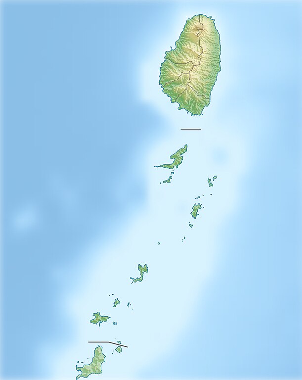
Deutsch: Physische Positionskarte von St. Vincent und die Grenadinen
Geographische Begrenzung der Karte:
English: Location map of Saint Vincent und the Grenadines
Geographic limits of the map:
|
| 날짜 | |
| 출처 |
자작, using
|
| 저자 | Carport |
| 저작권 (이 파일을 인용하기) |
이 파일은 크리에이티브 커먼즈 저작자표시-동일조건변경허락 3.0 Unported 라이선스로 배포됩니다.
|
| 다른 버전 |
|

파일 역사
날짜/시간 링크를 클릭하면 해당 시간의 파일을 볼 수 있습니다.
| 날짜/시간 | 섬네일 | 크기 | 사용자 | 설명 | |
|---|---|---|---|---|---|
| 현재 | 2013년 1월 1일 (화) 19:52 | | 1,060 × 1,332 (194 KB) | Carport | {{Information |Description= {{de|Physische Positionskarte von St. Vincent und die Grenadinen}} Geographische Begrenzung der Karte: * N: 13.42° N * S: 12.44° N * W: 61.7° W * O: 60.9° W {{en|Location map of [[:... |
이 파일을 사용하는 문서
다음 문서 1개가 이 파일을 사용하고 있습니다:
이 파일을 사용하고 있는 모든 위키의 문서 목록
다음 위키에서 이 파일을 사용하고 있습니다:
- ar.wikipedia.org에서 이 파일을 사용하고 있는 문서 목록
- ast.wikipedia.org에서 이 파일을 사용하고 있는 문서 목록
- az.wikipedia.org에서 이 파일을 사용하고 있는 문서 목록
- bg.wikipedia.org에서 이 파일을 사용하고 있는 문서 목록
- bn.wikipedia.org에서 이 파일을 사용하고 있는 문서 목록
- bs.wikipedia.org에서 이 파일을 사용하고 있는 문서 목록
- ceb.wikipedia.org에서 이 파일을 사용하고 있는 문서 목록
- da.wikipedia.org에서 이 파일을 사용하고 있는 문서 목록
- de.wikipedia.org에서 이 파일을 사용하고 있는 문서 목록
- St. Vincent und die Grenadinen
- Mustique
- Bequia
- Soufrière (St. Vincent)
- Union Island
- Canouan
- Tobago Cays
- Mayreau
- Palm Island (Grenadinen)
- Wikipedia:Kartenwerkstatt/Positionskarten/Nordamerika
- Petit St. Vincent
- Baliceaux
- Vorlage:Positionskarte St. Vincent und die Grenadinen
- Young Island (Grenadinen)
- Pigeon Island (Grenadinen)
- Saint Elairs Cay
- Samples Cay
- Grand Bonhomme
- All Awash Island
- Big Pillory
- Middle Pillory
- Little Pillory
- Rabbit Island (Grenadinen)
- Savan Island
- Little Savan
- Petit Canouan
- Petite Nevis
- Petite Mustique
- Isle à Quatre
- Wallilabou Bay
- Petit Bonhomme (St. Vincent)
- Mount Saint Andrew
- Milligan Cay
- Bettowia
- Church Cay
이 파일의 더 많은 사용 내역을 봅니다.